
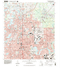
~ Sulphur Springs FL topo map, 1:24000 scale, 7.5 X 7.5 Minute, Historical, 1995, updated 1999
Sulphur Springs, Florida, USGS topographic map dated 1995.
Includes geographic coordinates (latitude and longitude). This topographic map is suitable for hiking, camping, and exploring, or framing it as a wall map.
Printed on-demand using high resolution imagery, on heavy weight and acid free paper, or alternatively on a variety of synthetic materials.
Topos available on paper, Waterproof, Poly, or Tyvek. Usually shipping rolled, unless combined with other folded maps in one order.
- Product Number: USGS-5628300
- Free digital map download (high-resolution, GeoPDF): Sulphur Springs, Florida (file size: 15 MB)
- Map Size: please refer to the dimensions of the GeoPDF map above
- Weight (paper map): ca. 55 grams
- Map Type: POD USGS Topographic Map
- Map Series: HTMC
- Map Verison: Historical
- Cell ID: 43701
- Scan ID: 348726
- Imprint Year: 1999
- Woodland Tint: Yes
- Aerial Photo Year: 1995
- Datum: NAD83
- Map Projection: Universal Transverse Mercator
- Map published by United States Geological Survey
- Map Language: English
- Scanner Resolution: 600 dpi
- Map Cell Name: Sulphur Springs
- Grid size: 7.5 X 7.5 Minute
- Date on map: 1995
- Map Scale: 1:24000
- Geographical region: Florida, United States
Neighboring Maps:
All neighboring USGS topo maps are available for sale online at a variety of scales.
Spatial coverage:
Topo map Sulphur Springs, Florida, covers the geographical area associated the following places:
- Walker Heights - Leighton Place - Rau Acres - Indian Head - North Pointe - Lake Ellen Grove - Rolling Green Village - Pine Lake - North Lowry Park - Tapps River Breeze - Lake Magdalene Forest - Iroquois Park - Riviera - Lindelaan - Greenmoor Grove - Willow Pines - California Heights Addition - Randolph Arbor - Mendoza - Cypress Head - Country Club Court - Cartertown - Eilers - Lake Magdalene - Lake Carroll Cove - Alta Vista - Orangewood Estates - Lutz Country Estates - Burrell Estates - Carrollwood - Matheny - Maffett - Scaglione - Vine Park - Lowry Lane - Flora Park - Betty Jean Heights - Terrace Overlook - Hampton Village - Oakhurst - Golden Terrace - Ralston Beach Manor - Dill - Lakewood Gardens - Hill Top Heights - River Grove Park - Woodland Terrace - Herchel Estates - Idlewild on the Hillsborough - Idle Grove Park - Habana Heights - Granville Manor - Sico - Nebraska Manor - Temple Terrace Gables - Altos Verdes - Royal Greens - Lake Ellen Walk - Catherine City - Thompson East - Griffin - Huntington by the Campus - Lake Britton - Pinehurst Park - Tampa Overlook - Wilma South - Marigold Gardens - Meadows Estates - Livingston Place - Temple Terrace Golfview - Del Rio - Riverhills Park - North Hillsboro - Dixie Terrace - Brompton Place - Imperial Estates - Emory Heights - Chapman - Patons Park View - Woodward Terrace - Sunrise Villas of Tampa - Hagin Lake Beach - Avalon Heights - Lake Carroll Drive - Seneca - Durolife Homes - Clewell Heights - Gardenia Heights - Nebraska Avenue Terrace - Tawesco Heights - Woodbriar Village - Crenshaw Acres - Fengos - Hillsboro Heights - Seminole Heights North - Sherwood Heights - Caleb Park - Hampton Lakes - Temple Braska - Linda Diane
- Map Area ID: AREA28.12528-82.5-82.375
- Northwest corner Lat/Long code: USGSNW28.125-82.5
- Northeast corner Lat/Long code: USGSNE28.125-82.375
- Southwest corner Lat/Long code: USGSSW28-82.5
- Southeast corner Lat/Long code: USGSSE28-82.375
- Northern map edge Latitude: 28.125
- Southern map edge Latitude: 28
- Western map edge Longitude: -82.5
- Eastern map edge Longitude: -82.375


