
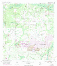
~ Lithia FL topo map, 1:24000 scale, 7.5 X 7.5 Minute, Historical, 1955, updated 1983
Lithia, Florida, USGS topographic map dated 1955.
Includes geographic coordinates (latitude and longitude). This topographic map is suitable for hiking, camping, and exploring, or framing it as a wall map.
Printed on-demand using high resolution imagery, on heavy weight and acid free paper, or alternatively on a variety of synthetic materials.
Topos available on paper, Waterproof, Poly, or Tyvek. Usually shipping rolled, unless combined with other folded maps in one order.
- Product Number: USGS-5625920
- Free digital map download (high-resolution, GeoPDF): Lithia, Florida (file size: 10 MB)
- Map Size: please refer to the dimensions of the GeoPDF map above
- Weight (paper map): ca. 55 grams
- Map Type: POD USGS Topographic Map
- Map Series: HTMC
- Map Verison: Historical
- Cell ID: 25904
- Scan ID: 347231
- Imprint Year: 1983
- Woodland Tint: Yes
- Photo Revision Year: 1972
- Aerial Photo Year: 1972
- Survey Year: 1955
- Datum: NAD27
- Map Projection: Polyconic
- Map published by United States Geological Survey
- Map Language: English
- Scanner Resolution: 600 dpi
- Map Cell Name: Lithia
- Grid size: 7.5 X 7.5 Minute
- Date on map: 1955
- Map Scale: 1:24000
- Geographical region: Florida, United States
Neighboring Maps:
All neighboring USGS topo maps are available for sale online at a variety of scales.
Spatial coverage:
Topo map Lithia, Florida, covers the geographical area associated the following places:
- Capitano Estates - Jacobs Run - Miller Estates - Tierra de Amigos - Pinecrest - Natures Place - South County Estates - Villages At Lithia - Hendry Estates - Princess Estates - Lithia - Hammock Oaks Reserve - Fish Hawk - Doe Branch - Doe Creek Reserve - Lithia Pines - Fish Hawk Farms - Climer Estates - Parkside Village - Dorman Meadows - Shelley Lakes Estates - Wendel Wood - Hinton Ranch - Holland Acres - Aldermans Ford - Fishhawk Ranch - Conway Estates - Lithia Estates - Karlson Acres - Dorman Acres - Dixon Country Estates - Devore Gundog and Equestrian Estates - Streetman Acres - Lithia Ranch - Martindale Acres - Boyette - Kavita Estates - Lynn Estates - Lightfoot Acres - Hood Manor Estates - Dorman Ranch - Fish Hawk Trails - Mannhurst Oak Manors - Candlewood Acres - Serenity Acres - Great Oaks
- Map Area ID: AREA27.87527.75-82.25-82.125
- Northwest corner Lat/Long code: USGSNW27.875-82.25
- Northeast corner Lat/Long code: USGSNE27.875-82.125
- Southwest corner Lat/Long code: USGSSW27.75-82.25
- Southeast corner Lat/Long code: USGSSE27.75-82.125
- Northern map edge Latitude: 27.875
- Southern map edge Latitude: 27.75
- Western map edge Longitude: -82.25
- Eastern map edge Longitude: -82.125


