
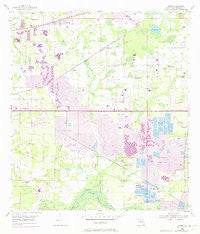
~ Dover FL topo map, 1:24000 scale, 7.5 X 7.5 Minute, Historical, 1955, updated 1972
Dover, Florida, USGS topographic map dated 1955.
Includes geographic coordinates (latitude and longitude). This topographic map is suitable for hiking, camping, and exploring, or framing it as a wall map.
Printed on-demand using high resolution imagery, on heavy weight and acid free paper, or alternatively on a variety of synthetic materials.
Topos available on paper, Waterproof, Poly, or Tyvek. Usually shipping rolled, unless combined with other folded maps in one order.
- Product Number: USGS-5623618
- Free digital map download (high-resolution, GeoPDF): Dover, Florida (file size: 10 MB)
- Map Size: please refer to the dimensions of the GeoPDF map above
- Weight (paper map): ca. 55 grams
- Map Type: POD USGS Topographic Map
- Map Series: HTMC
- Map Verison: Historical
- Cell ID: 12691
- Scan ID: 345875
- Imprint Year: 1972
- Woodland Tint: Yes
- Photo Revision Year: 1973
- Aerial Photo Year: 1972
- Survey Year: 1955
- Datum: NAD27
- Map Projection: Polyconic
- Map published by United States Geological Survey
- Map Language: English
- Scanner Resolution: 600 dpi
- Map Cell Name: Dover
- Grid size: 7.5 X 7.5 Minute
- Date on map: 1955
- Map Scale: 1:24000
- Geographical region: Florida, United States
Neighboring Maps:
All neighboring USGS topo maps are available for sale online at a variety of scales.
Spatial coverage:
Topo map Dover, Florida, covers the geographical area associated the following places:
- Evers Acres - Brandon East - Toole Place - Buckhorn Groves - Twin Oaks - Country Brook Estates - Oakwood Forest - Canter - Shady Stables - Buckhorn Run - Mason Oaks - Citrus Wood - Ruffin Acres - Somerset - Sunny Hill - Hopewell Gardens - Trails at Durant - Martin - Bent Tree Estates - Olympus Acres - Cimmaron - Brandon Valrico Hills Estates - Brown Estates - Bloomingdale - Brock Acres - Delarua - Pleasant Grove - Buckingham - Lees Ranch - Chancey - Saint Cloud Manor - Walden Lake - Dover - Kaylas Cove - Turkey Hollow - Waller Acres - Thompson Oaks - Tevalo Hills - Marlyn Manor - Marvinia Hills - McGraths Orangettes - The Cove - Canterbury Oaks - Holloway Plantation - Jerrys - Puntkins Patch - Irvine Heights - Windcrest Commons - Popago Estates - Parkwood Manor - Arista - Doris Swilley Acres - Pleasant Grove Acres - Springdell Estates - Greenhills - Orchid Grove - Woodfield Village - Buckhorn Oaks - Sytsma Estates - Hinson Acres - The Paddocks - Duncan Groves - Oaklane Estates - Gillespies Glen - Saint Cloud Landings - Holloway Creek - Valrico Heights - Stone Hollow - Hidden Forest East - Brookdale Farms - Memory Lane - Siloam Springs Wood - Parrish - Colony South - Sugarloaf Ridge - Lovitis Park - Durant - Abbey Grove - Highland Country Estates - Dover Park - Raulerson Estates North - Lithia Ridge - Rosswell Acres - Camden Oaks - Critter Lane - Walden Lake Fairway Villas - Connell Groves - The Dryden Estates - Porter Acres - Oakwood Estates - Cinnamon Trace - Miller Woods - Davis Acres - Eastwood Glenn - McIntosh Lakes - Delgado - Register Place - Graves Orchard - Redd - Country Woods Estates
- Map Area ID: AREA2827.875-82.25-82.125
- Northwest corner Lat/Long code: USGSNW28-82.25
- Northeast corner Lat/Long code: USGSNE28-82.125
- Southwest corner Lat/Long code: USGSSW27.875-82.25
- Southeast corner Lat/Long code: USGSSE27.875-82.125
- Northern map edge Latitude: 28
- Southern map edge Latitude: 27.875
- Western map edge Longitude: -82.25
- Eastern map edge Longitude: -82.125


