
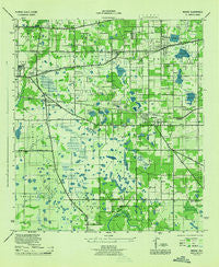
~ Mango FL topo map, 1:31680 scale, 7.5 X 7.5 Minute, Historical, 1944
Mango, Florida, USGS topographic map dated 1944.
Includes geographic coordinates (latitude and longitude). This topographic map is suitable for hiking, camping, and exploring, or framing it as a wall map.
Printed on-demand using high resolution imagery, on heavy weight and acid free paper, or alternatively on a variety of synthetic materials.
Topos available on paper, Waterproof, Poly, or Tyvek. Usually shipping rolled, unless combined with other folded maps in one order.
- Product Number: USGS-5620882
- Free digital map download (high-resolution, GeoPDF): Mango, Florida (file size: 7 MB)
- Map Size: please refer to the dimensions of the GeoPDF map above
- Weight (paper map): ca. 55 grams
- Map Type: POD USGS Topographic Map
- Map Series: HTMC
- Map Verison: Historical
- Cell ID: 5263
- Scan ID: 347335
- Woodland Tint: Yes
- Aerial Photo Year: 1942
- Datum: NAD27
- Map Projection: Polyconic
- Map published by United States Army Corps of Engineers
- Map published by United States Department of War
- Map Language: English
- Scanner Resolution: 600 dpi
- Map Cell Name: Brandon
- Grid size: 7.5 X 7.5 Minute
- Date on map: 1944
- Map Scale: 1:31680
- Geographical region: Florida, United States
Neighboring Maps:
All neighboring USGS topo maps are available for sale online at a variety of scales.
Spatial coverage:
Topo map Mango, Florida, covers the geographical area associated the following places:
- Abbey Trace - Cash Acres - Amys Acres - Kingsway Downs - Oaklan - Easy Way - Hickory Woods - Valrico Heights Estates - Melanie Manor - Stonewood - Broadway Heights East - Oakwood Heights - Faulkenburg Heights - Garden Oaks - Benson - Eden Park - Pine Grove Reserve - Pemberton Place - Brentwood Hills - Progress Village - Woodmere Heights - Branda Vista - Cashin Oaks - High View Terrace - Brandon Meadows - Hudson Estates - Sterling Ranch - Seffner - Mango Terrace - Colonial Oaks - Brandon Lake Park - Rolling Acres - Suntree Estates - Sugarcreek - Waldrop Estates - Westwood - Four Winds Estates - Holiday Hills - Raven Oaks - Legacy Park - Lynwood Park - Orange Grove Estates - Ridge Court - Brandon - Wheelers Landing - Brandon Spanish Oaks - Hollington Oaks - Hillside Manor - Carriage Crossing - Villages of Bloomingdale - Lake Weeks - Brandon Country Estates - Hillcrest - Eastside Mobile Villa - Valrico Lake - Lakemont Hills - Brandon Mobile Estates - Barrington Oaks East - Scanlon Country Estates - Van Sant - Krycuil Oaks Estates - Buckingham Place - Shadow Bay - Madrona Heights - Plantation Estates - Bates - Kingswood Heights - Hillside - Brandon Gardens - Melodie Park - Brandon Ridge - Bryant Terrace - Alafia Estates - Jess Walden Oaks - Wheeler Crossings - Brandon Oak Grove Estates - Kingsway Oaks - Avalon Terrace - Estates at Limona Woods - Brandon Lakes - High Point Estates - Brandon Valley - Timber Pond - Watermill at Providence Lakes - Valhalla - Lake Marie Mobile Estates - Chelsea Manor - Old Hillsborough Estates - Chestnut Forest - Green Ridge Estates - South Ridge - Candlewood - Valrico Vista - Larrie Ellen Park - North Hill - Paka Estates - Sixmile Creek - Cien Fuegos - Stevens Manor - Bryan Manor
- Map Area ID: AREA2827.875-82.375-82.25
- Northwest corner Lat/Long code: USGSNW28-82.375
- Northeast corner Lat/Long code: USGSNE28-82.25
- Southwest corner Lat/Long code: USGSSW27.875-82.375
- Southeast corner Lat/Long code: USGSSE27.875-82.25
- Northern map edge Latitude: 28
- Southern map edge Latitude: 27.875
- Western map edge Longitude: -82.375
- Eastern map edge Longitude: -82.25


