
~ Pioche NV topo map, 1:250000 scale, 1 X 1 Degree, Historical, 1885
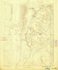
Pioche, Nevada, USGS topographic map dated 1885.
Includes geographic coordinates (latitude and longitude). This topographic map is suitable for hiking, camping, and exploring, or framing it as a wall map.
Printed on-demand using high resolution imagery, on heavy weight and acid free paper, or alternatively on a variety of synthetic materials.
Topos available on paper, Waterproof, Poly, or Tyvek. Usually shipping rolled, unless combined with other folded maps in one order.
- Product Number: USGS-5618794
- Free digital map download (high-resolution, GeoPDF): Pioche, Nevada (file size: 6 MB)
- Map Size: please refer to the dimensions of the GeoPDF map above
- Weight (paper map): ca. 55 grams
- Map Type: POD USGS Topographic Map
- Map Series: HTMC
- Map Verison: Historical
- Cell ID: 322246
- Scan ID: 321753
- Datum: Unstated
- Map Projection: Unstated
- Map published by United States Geological Survey
- Map Language: English
- Scanner Resolution: 600 dpi
- Map Cell Name: Caliente E
- Grid size: 1 X 1 Degree
- Date on map: 1885
- Map Scale: 1:250000
- Geographical region: Nevada, United States
Neighboring Maps:
All neighboring USGS topo maps are available for sale online at a variety of scales.
Spatial coverage:
Topo map Pioche, Nevada, covers the geographical area associated the following places:
- Crossroads - Helene - Carp - Ninemile Rocks - Bullionville (historical) - Rose Valley - Flat Nose - Big Trees - Cold Spring - Galt - Prince - Viola (historical) - Fay (historical) - Caselton - Horseshoe Bend - Stine - Panaca - Crestline - Strawberry Hill - Highland (historical) - Islen - Kershaw (historical) - Kyle - Etna - Joseco - Acoma - Brown - Delmues (historical) - Caliente - Deer Lodge (historical) - Mendha - Ursine - Pioche - Caselton Heights - Princeton (historical) - Barclay - Ferguson (historical) - State Line - Boyd - Eccles - Delamar - Angle City - Kiernan (historical) - Yoacham (historical) - Indian Cove - Elgin
- Map Area ID: AREA3837-115-114
- Northwest corner Lat/Long code: USGSNW38-115
- Northeast corner Lat/Long code: USGSNE38-114
- Southwest corner Lat/Long code: USGSSW37-115
- Southeast corner Lat/Long code: USGSSE37-114
- Northern map edge Latitude: 38
- Southern map edge Latitude: 37
- Western map edge Longitude: -115
- Eastern map edge Longitude: -114


