
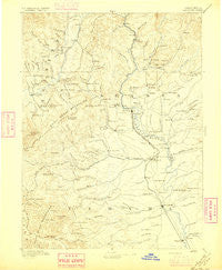
~ Red Bluff CA topo map, 1:250000 scale, 1 X 1 Degree, Historical, 1894, updated 1896
Red Bluff, California, USGS topographic map dated 1894.
Includes geographic coordinates (latitude and longitude). This topographic map is suitable for hiking, camping, and exploring, or framing it as a wall map.
Printed on-demand using high resolution imagery, on heavy weight and acid free paper, or alternatively on a variety of synthetic materials.
Topos available on paper, Waterproof, Poly, or Tyvek. Usually shipping rolled, unless combined with other folded maps in one order.
- Product Number: USGS-5618490
- Free digital map download (high-resolution, GeoPDF): Red Bluff, California (file size: 7 MB)
- Map Size: please refer to the dimensions of the GeoPDF map above
- Weight (paper map): ca. 55 grams
- Map Type: POD USGS Topographic Map
- Map Series: HTMC
- Map Verison: Historical
- Cell ID: 322284
- Scan ID: 299844
- Imprint Year: 1896
- Survey Year: 1884
- Datum: Unstated
- Map Projection: Unstated
- Map published by United States Geological Survey
- Map Language: English
- Scanner Resolution: 600 dpi
- Map Cell Name: Redding E
- Grid size: 1 X 1 Degree
- Date on map: 1894
- Map Scale: 1:250000
- Geographical region: California, United States
Neighboring Maps:
All neighboring USGS topo maps are available for sale online at a variety of scales.
Spatial coverage:
Topo map Red Bluff, California, covers the geographical area associated the following places:
- Bully Hill - Westend Galatin Place (historical) - Leonard Place (historical) - El Rio Estates - Saunders Place - Banfield Place - Paige Bar - Alford Place - Heitman Place (historical) - Hammer Place - Henryford (historical) - Pinewood Cove - Churntown (historical) - Enterprise Mobile Park - Centerville - Gilliam Place - Mountain Gate - Shasta - Fitzpatrick (historical) - Delta - Beegum - Rancho Tehama Reserve - El Camino - Iron Mountain - Whitehouse (historical) - Enterprise - Fairway Oaks Mobile Home Park - Motion - French Gulch - Portal Inn - Skinner Mill Place - Wilkinson - McColl - Minnesota - Antlers - Cottonwood - Platina - Hercraff Place - Haven Place - Red Bluff - Trinity Center - Safari Mobile Home Park - Buckeye - Project City (historical) - McCartney Place - Redding - Montgomery Place - Ingot - Bayles Place - Los Molinos - Rapid River Mobile Home Park - Brown Place - Los Robles Estates - Mabel (historical) - Amberwood Mobile Home Park - Douglas City - Reddingwood Mobile Home Park - Dairyville - Smith - Houston (historical) - Clear Creek Mobile Home Park - Lillienthal (historical) - Vollmers - Mountain Shadows Mobile Home Estates - Furnaceville (historical) - Riviera Mobile Estates - Shackleford Place - Marina Travel Park - Lewiston - Watson - Baird (historical) - Sherman - Newtown - Middletown (historical) - Churn Creek Mobile Home Park - Deluxe Mobile Park - Bucktail - Twin View Terrace Mobile Home Park - Winthrop (historical) - Osborne - Quartz Point Mobile Home Park - Oak Run - Bella Vista - Calkins (historical) - Country Aire Mobile Home Park - Lakehead - Central Valley (historical) - Bend - Morley (historical) - Starlite Mobile Estates - Redding Lakeside Mobile Estates - Dales - Lakeview Resort - Country Club Mobile Estates - Balls Ferry Fishing Resort - Pettyjohn Place - Kiska - Fairview - Cold Fork - Wagoner
- Map Area ID: AREA4140-123-122
- Northwest corner Lat/Long code: USGSNW41-123
- Northeast corner Lat/Long code: USGSNE41-122
- Southwest corner Lat/Long code: USGSSW40-123
- Southeast corner Lat/Long code: USGSSE40-122
- Northern map edge Latitude: 41
- Southern map edge Latitude: 40
- Western map edge Longitude: -123
- Eastern map edge Longitude: -122


