
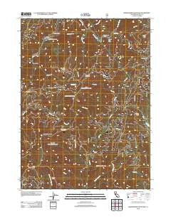
~ Shoeinhorse Mountain CA topo map, 1:24000 scale, 7.5 X 7.5 Minute, Historical, 2012
Shoeinhorse Mountain, California, USGS topographic map dated 2012.
Includes geographic coordinates (latitude and longitude). This topographic map is suitable for hiking, camping, and exploring, or framing it as a wall map.
Printed on-demand using high resolution imagery, on heavy weight and acid free paper, or alternatively on a variety of synthetic materials.
Topos available on paper, Waterproof, Poly, or Tyvek. Usually shipping rolled, unless combined with other folded maps in one order.
- Product Number: USGS-5603434
- Free digital map download (high-resolution, GeoPDF): Shoeinhorse Mountain, California (file size: 26 MB)
- Map Size: please refer to the dimensions of the GeoPDF map above
- Weight (paper map): ca. 55 grams
- Map Type: POD USGS Topographic Map
- Map Series: US Topo
- Map Verison: Historical
- Cell ID: 41149
- Datum: North American Datum of 1983
- Map Projection: Transverse Mercator
- Map Cell Name: Shoeinhorse Mountain
- Grid size: 7.5 X 7.5 Minute
- Date on map: 2012
- Map Scale: 1:24000
- Geographical region: California, United States
Neighboring Maps:
All neighboring USGS topo maps are available for sale online at a variety of scales.
Spatial coverage:
Topo map Shoeinhorse Mountain, California, covers the geographical area associated the following places:
- Hornet Gulch - Van Sicklin Butte - Buck Ridge - Shoeinhorse Mountain - Ah-Di-Na Campground - Fitzhugh Gulch - Sheep Creek - Horned Owl Gulch - Brushy Butte - Spring Creek - Ghost Camp - Mink Creek - Happy Hunting Grounds - Butcherknife Creek - Muddy Spring Creek - Coyote Peak - Deer Creek - Jessie Creek - Ah-Di-Na - Squirrel Creek - Bones Gulch - Prospect Creek - Little Bagley Mountain - Sheep Camp - Ladybug Creek - West Fork Squaw Creek - Hawkins Creek - Fish Creek - Gap Creek - Curl Ridge Jeep Trail - North Fork Mountain - Horse Creek - Ladybug Butte - Ash Camp - Little Shoeinhorse Mountain - Centipede Creek - Tamarack Mountain - Garden Ridge - Doodlebug Gulch - McKenzie Mountain
- Map Area ID: AREA41.12541-122.125-122
- Northwest corner Lat/Long code: USGSNW41.125-122.125
- Northeast corner Lat/Long code: USGSNE41.125-122
- Southwest corner Lat/Long code: USGSSW41-122.125
- Southeast corner Lat/Long code: USGSSE41-122
- Northern map edge Latitude: 41.125
- Southern map edge Latitude: 41
- Western map edge Longitude: -122.125
- Eastern map edge Longitude: -122


