
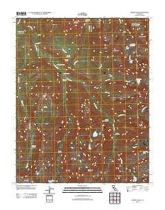
~ Sphinx Lakes CA topo map, 1:24000 scale, 7.5 X 7.5 Minute, Historical, 2012
Sphinx Lakes, California, USGS topographic map dated 2012.
Includes geographic coordinates (latitude and longitude). This topographic map is suitable for hiking, camping, and exploring, or framing it as a wall map.
Printed on-demand using high resolution imagery, on heavy weight and acid free paper, or alternatively on a variety of synthetic materials.
Topos available on paper, Waterproof, Poly, or Tyvek. Usually shipping rolled, unless combined with other folded maps in one order.
- Product Number: USGS-5603072
- Free digital map download (high-resolution, GeoPDF): Sphinx Lakes, California (file size: 25 MB)
- Map Size: please refer to the dimensions of the GeoPDF map above
- Weight (paper map): ca. 55 grams
- Map Type: POD USGS Topographic Map
- Map Series: US Topo
- Map Verison: Historical
- Cell ID: 42488
- Datum: North American Datum of 1983
- Map Projection: Transverse Mercator
- Map Cell Name: Sphinx Lakes
- Grid size: 7.5 X 7.5 Minute
- Date on map: 2012
- Map Scale: 1:24000
- Geographical region: California, United States
Neighboring Maps:
All neighboring USGS topo maps are available for sale online at a variety of scales.
Spatial coverage:
Topo map Sphinx Lakes, California, covers the geographical area associated the following places:
- Moraine Ridge - Scaffold Meadows - Cross Mountain - Cement Table Meadow - Table Creek - Lackeys Cabin - Palmer Mountain - Talus Lake - Barton Creek - Whaleback - Roaring River Ranger Station - Moraine Creek - Colby Lake - Cloud Canyon - Moraine Meadows - Glacier Ridge - Sphinx Crest - Josephine Lake - Avalanche Pass - Ferguson Meadow - Ranger Meadow - Shortys Cabin - Brewer Creek - Deadman Canyon - Big Brewer Lake - Big Wet Meadow - Barton-Lackey Cabin - West Fork Ferguson Creek - Barton Peak - Scenic Meadow - Sphinx Lakes - Sequoia-Kings Canyon Wilderness - Tableland - Cunningham Creek
- Map Area ID: AREA36.7536.625-118.625-118.5
- Northwest corner Lat/Long code: USGSNW36.75-118.625
- Northeast corner Lat/Long code: USGSNE36.75-118.5
- Southwest corner Lat/Long code: USGSSW36.625-118.625
- Southeast corner Lat/Long code: USGSSE36.625-118.5
- Northern map edge Latitude: 36.75
- Southern map edge Latitude: 36.625
- Western map edge Longitude: -118.625
- Eastern map edge Longitude: -118.5


