
~ West Point MS topo map, 1:250000 scale, 1 X 2 Degree, Historical, 1984, updated 1984
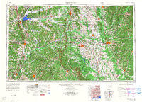
West Point, Mississippi, USGS topographic map dated 1984.
Includes geographic coordinates (latitude and longitude). This topographic map is suitable for hiking, camping, and exploring, or framing it as a wall map.
Printed on-demand using high resolution imagery, on heavy weight and acid free paper, or alternatively on a variety of synthetic materials.
Topos available on paper, Waterproof, Poly, or Tyvek. Usually shipping rolled, unless combined with other folded maps in one order.
- Product Number: USGS-5599136
- Free digital map download (high-resolution, GeoPDF): West Point, Mississippi (file size: 21 MB)
- Map Size: please refer to the dimensions of the GeoPDF map above
- Weight (paper map): ca. 55 grams
- Map Type: POD USGS Topographic Map
- Map Series: HTMC
- Map Verison: Historical
- Cell ID: 69095
- Scan ID: 707684
- Imprint Year: 1984
- Woodland Tint: Yes
- Visual Version Number: 3
- Datum: Unstated
- Map Projection: Transverse Mercator
- Map published by United States Army Corps of Engineers
- Map Language: English
- Scanner Resolution: 508 dpi
- Map Cell Name: West Point
- Grid size: 1 X 2 Degree
- Date on map: 1984
- Map Scale: 1:250000
- Geographical region: Mississippi, United States
Neighboring Maps:
All neighboring USGS topo maps are available for sale online at a variety of scales.
Spatial coverage:
Topo map West Point, Mississippi, covers the geographical area associated the following places:
- Pine Hill Estates - Elize (historical) - Morgantown - East Macedonia - Tomnolen - Randalls Bluff (historical) - Lynn Estates - Misterton - Glendale (historical) - Lackey - Fairview (historical) - Holly Hills - Bolivar (historical) - Carloss - Patrick - Oktibbeha Gardens - Paul - Rocky Point - Sherwood Forest - University Heights - Pierces Chapel - Southland Park - Melco Subdivision - McAdams - Mashulaville - Eskridge - Walthall - Ashland (historical) - Mormon Springs - Tolar Subdivision - Tillatoba - Estes - Gardenspot Subdivision - Wildwood - Downs Subdivision - Colonial Acres - Arrington Park - Northgate - Waverly - Lake Monroe West Subdivision - Bruce - Propst Highlands - Ethelsville - Beatty - Sugar Hill - Cunningham - Gum Springs - Willcox (historical) - Hillbrook - Amory - Hopewell - Pleasant Ridge (historical) - Black Jack - Retreat - Sheely Hills - Pellez - New Hamilton - Grantsville (historical) - Duck Hill - Corrine (historical) - Bigbee Valley - Eupora - Turkey Creek - Cedar Point - Fearns Springs - Glenwild - Doyle Estates - Pittman - Love Subdivision - Bent Tree Plantation - Gums - Joplin (historical) - Lynn Creek - Sweatman - Dillburg - Whites Creek East - Cotton Hill Gin Estates - Beasley - Millcreek - Wise Gap - Youngs - Center Point (historical) - Stansel - Mercer (historical) - Huntsville - Woodland Heights - Ackerman - Armitage (historical) - Whites - Edgefield (historical) - Shaw - Belaire Estates - Conner Heights - Hyde - Vaiden - Gladneyville (historical) - Pinecrest - Center - Weir - Big Creek
- Map Area ID: AREA3433-90-88
- Northwest corner Lat/Long code: USGSNW34-90
- Northeast corner Lat/Long code: USGSNE34-88
- Southwest corner Lat/Long code: USGSSW33-90
- Southeast corner Lat/Long code: USGSSE33-88
- Northern map edge Latitude: 34
- Southern map edge Latitude: 33
- Western map edge Longitude: -90
- Eastern map edge Longitude: -88


