
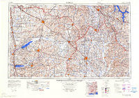
~ Tupelo MS topo map, 1:250000 scale, 1 X 2 Degree, Historical, 1984, updated 1984
Tupelo, Mississippi, USGS topographic map dated 1984.
Includes geographic coordinates (latitude and longitude). This topographic map is suitable for hiking, camping, and exploring, or framing it as a wall map.
Printed on-demand using high resolution imagery, on heavy weight and acid free paper, or alternatively on a variety of synthetic materials.
Topos available on paper, Waterproof, Poly, or Tyvek. Usually shipping rolled, unless combined with other folded maps in one order.
- Product Number: USGS-5599116
- Free digital map download (high-resolution, GeoPDF): Tupelo, Mississippi (file size: 18 MB)
- Map Size: please refer to the dimensions of the GeoPDF map above
- Weight (paper map): ca. 55 grams
- Map Type: POD USGS Topographic Map
- Map Series: HTMC
- Map Verison: Historical
- Cell ID: 69065
- Scan ID: 707643
- Imprint Year: 1984
- Visual Version Number: 1
- Datum: Unstated
- Map Projection: Transverse Mercator
- Map published by United States Army Corps of Engineers
- Map Language: English
- Scanner Resolution: 508 dpi
- Map Cell Name: Tupelo
- Grid size: 1 X 2 Degree
- Date on map: 1984
- Map Scale: 1:250000
- Geographical region: Mississippi, United States
Neighboring Maps:
All neighboring USGS topo maps are available for sale online at a variety of scales.
Spatial coverage:
Topo map Tupelo, Mississippi, covers the geographical area associated the following places:
- Stonewall - Flowerdale - Chickasaw (historical) - Hernando - Graves - Petertown - Rolling Woods - Aiken - Boggan Grove - Bald Hill - Mount Olive (historical) - Henson Springs - Rogers Acres - Central Grove - Oakcliff Villas - Hideaway Hills - Jericho - Buena Vista - Oakland - Ridgeland - Wheeler - Mooreville - Etta - Tupelo - Senatobia Lakes - Waites - Gift - Eggville - Michigan City - Macedonia - Paden - Ripley - Rough Edge - Branyan - Pleasant Hill - Mingo - Belden - Oak Grove (historical) - Mitchell - Sardis - Cornersville - Cotton Plant - Slayden - Whitten Town - Chapelville - Possum Trot - McGhee - Allentown - Yocona - Nettleton - Blackland - Snow Lake Shores - Haven Acres - Turnpike - Dorsey - Center Point (historical) - Como - Shottsville - Miller - Victoria - Center - Love - Leotis - Rollings Woods - Johnson Heights - Floyton (historical) - Ozark - Terrace Park - Van Buren - Senatobia - East Prentiss - Evergreen - Mathews (historical) - Plum Point - Mahon - Rocky Ford - Prairie Mount (historical) - Biggersville - Birmingham - Clark Place - Burntout - Spring Hill - Spraggins - Old Union - Bristow - Darden - Lebanon - New Salem - Skyline - Byhalia - Flinn - Bynum - Palmetto - Molino - Endville - Robbs - Mount Zion - Blythes Chapel - Lamar - Longview
- Map Area ID: AREA3534-90-88
- Northwest corner Lat/Long code: USGSNW35-90
- Northeast corner Lat/Long code: USGSNE35-88
- Southwest corner Lat/Long code: USGSSW34-90
- Southeast corner Lat/Long code: USGSSE34-88
- Northern map edge Latitude: 35
- Southern map edge Latitude: 34
- Western map edge Longitude: -90
- Eastern map edge Longitude: -88


