
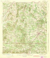
~ Terry MS topo map, 1:62500 scale, 15 X 15 Minute, Historical, 1943
Terry, Mississippi, USGS topographic map dated 1943.
Includes geographic coordinates (latitude and longitude). This topographic map is suitable for hiking, camping, and exploring, or framing it as a wall map.
Printed on-demand using high resolution imagery, on heavy weight and acid free paper, or alternatively on a variety of synthetic materials.
Topos available on paper, Waterproof, Poly, or Tyvek. Usually shipping rolled, unless combined with other folded maps in one order.
- Product Number: USGS-5598818
- Free digital map download (high-resolution, GeoPDF): Terry, Mississippi (file size: 8 MB)
- Map Size: please refer to the dimensions of the GeoPDF map above
- Weight (paper map): ca. 55 grams
- Map Type: POD USGS Topographic Map
- Map Series: HTMC
- Map Verison: Historical
- Cell ID: 63462
- Scan ID: 337116
- Woodland Tint: Yes
- Survey Year: 1937
- Datum: NAD27
- Map Projection: Polyconic
- Map published by United States Geological Survey
- Map Language: English
- Scanner Resolution: 600 dpi
- Map Cell Name: Terry
- Grid size: 15 X 15 Minute
- Date on map: 1943
- Map Scale: 1:62500
- Geographical region: Mississippi, United States
Neighboring Maps:
All neighboring USGS topo maps are available for sale online at a variety of scales.
Spatial coverage:
Topo map Terry, Mississippi, covers the geographical area associated the following places:
- Palestine - Bethesda - Thompsonville - Brookwood Pines - Brookleigh - Heritage Estates - Fairchilds Crossroads - Spring Ridge - Midway - Briarcliff - Lake Ridgelea Subdivision - Windsor Forest - Lost Lake - Siwel - New Byram - Egypt Hill - Morgans Store - Dry Grove - Dabney Crossroads - Moncure - Sunkist - Pine Grove - Terry - Raintree Place - Seven Springs - Bernard - Gary Estates - Harperville (historical) - Brookwood - Rosemary
- Map Area ID: AREA32.2532-90.5-90.25
- Northwest corner Lat/Long code: USGSNW32.25-90.5
- Northeast corner Lat/Long code: USGSNE32.25-90.25
- Southwest corner Lat/Long code: USGSSW32-90.5
- Southeast corner Lat/Long code: USGSSE32-90.25
- Northern map edge Latitude: 32.25
- Southern map edge Latitude: 32
- Western map edge Longitude: -90.5
- Eastern map edge Longitude: -90.25


