
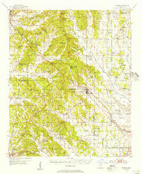
~ Sherman MS topo map, 1:62500 scale, 15 X 15 Minute, Historical, 1955, updated 1956
Sherman, Mississippi, USGS topographic map dated 1955.
Includes geographic coordinates (latitude and longitude). This topographic map is suitable for hiking, camping, and exploring, or framing it as a wall map.
Printed on-demand using high resolution imagery, on heavy weight and acid free paper, or alternatively on a variety of synthetic materials.
Topos available on paper, Waterproof, Poly, or Tyvek. Usually shipping rolled, unless combined with other folded maps in one order.
- Product Number: USGS-5598768
- Free digital map download (high-resolution, GeoPDF): Sherman, Mississippi (file size: 10 MB)
- Map Size: please refer to the dimensions of the GeoPDF map above
- Weight (paper map): ca. 55 grams
- Map Type: POD USGS Topographic Map
- Map Series: HTMC
- Map Verison: Historical
- Cell ID: 62445
- Scan ID: 337091
- Imprint Year: 1956
- Woodland Tint: Yes
- Aerial Photo Year: 1947
- Field Check Year: 1955
- Datum: NAD27
- Map Projection: Polyconic
- Map published by United States Geological Survey
- Map Language: English
- Scanner Resolution: 600 dpi
- Map Cell Name: Sherman
- Grid size: 15 X 15 Minute
- Date on map: 1955
- Map Scale: 1:62500
- Geographical region: Mississippi, United States
Neighboring Maps:
All neighboring USGS topo maps are available for sale online at a variety of scales.
Spatial coverage:
Topo map Sherman, Mississippi, covers the geographical area associated the following places:
- Mount Vernon - Poplar Springs - Endville - Nixon - Alpine - Ellistown - Chesterville - Sherman - Beacon Hill - Frog Island - New Harmony - Wildwood - Blue Springs - Corrona - Center - Reese - Wallerville - Graves - Macedonia - Boggan Bend - Oak Hill - Traceland - Tracewood - Longview - Rough Edge - Cherry Creek - Parks - Union Hill - Birmingham - Branyan - Jug Fork - Mound City - Fairfield - Belden
- Map Area ID: AREA34.534.25-89-88.75
- Northwest corner Lat/Long code: USGSNW34.5-89
- Northeast corner Lat/Long code: USGSNE34.5-88.75
- Southwest corner Lat/Long code: USGSSW34.25-89
- Southeast corner Lat/Long code: USGSSE34.25-88.75
- Northern map edge Latitude: 34.5
- Southern map edge Latitude: 34.25
- Western map edge Longitude: -89
- Eastern map edge Longitude: -88.75


