
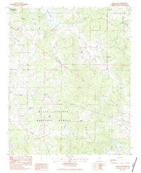
~ Coker Lake MS topo map, 1:24000 scale, 7.5 X 7.5 Minute, Historical, 1983, updated 1983
Coker Lake, Mississippi, USGS topographic map dated 1983.
Includes geographic coordinates (latitude and longitude). This topographic map is suitable for hiking, camping, and exploring, or framing it as a wall map.
Printed on-demand using high resolution imagery, on heavy weight and acid free paper, or alternatively on a variety of synthetic materials.
Topos available on paper, Waterproof, Poly, or Tyvek. Usually shipping rolled, unless combined with other folded maps in one order.
- Product Number: USGS-5595730
- Free digital map download (high-resolution, GeoPDF): Coker Lake, Mississippi (file size: 11 MB)
- Map Size: please refer to the dimensions of the GeoPDF map above
- Weight (paper map): ca. 55 grams
- Map Type: POD USGS Topographic Map
- Map Series: HTMC
- Map Verison: Historical
- Cell ID: 9483
- Scan ID: 335499
- Imprint Year: 1983
- Woodland Tint: Yes
- Aerial Photo Year: 1978
- Edit Year: 1983
- Field Check Year: 1982
- Datum: NAD27
- Map Projection: Transverse Mercator
- Provisional map: Yes
- Map published by United States Geological Survey
- Map Language: English
- Scanner Resolution: 600 dpi
- Map Cell Name: Coker Lake
- Grid size: 7.5 X 7.5 Minute
- Date on map: 1983
- Map Scale: 1:24000
- Geographical region: Mississippi, United States
Neighboring Maps:
All neighboring USGS topo maps are available for sale online at a variety of scales.
Spatial coverage:
Topo map Coker Lake, Mississippi, covers the geographical area associated the following places:
- Fords Cemetery - Walker Lake - Locust Grove Church - Tillatoba Creek Y-17b-9 Dam - Locust Grove School - Lick Branch School - Saint Andrews Cemetery - Guess Cemetery - Long Branch Cemetery - Saint Andrews Church - Tillatoba Creek Watershed Y-17b-8 Dam - Fords Well (historical) - Sweet Home Church - Swearengen Lake - Zion Grove Cemetery - Philadelphia Church - Chesnut Lake - Coker Lake - Scurlock Lake - Yo-26-8 Dam - Cypress Creek Watershed Y-19a-5 Dam - Buck Hill (historical) - Sardinia Cemetery - Benson Cemetery - Cypress Creek Watershed Y-19a-7 Dam - Zion Grove Church - Salem Cemetery - Dunavant Lake - Larry Dyer Pond Dam - W B Donovan Lake Dam - Erost Creek - Spring Hill Cemetery - Coffeeville Lookout Tower - Hatton (historical) - Roberson School - Jackson Lake - Tom Bell Lake Dam - Supervisor District 4 - Goshen Church - Pipkin Cemetery - Roberson Chapel - Swearengen Cemetery - Sayles Cemetery - Cypress Creek Watershed Y-19a-9 Dam - Nebo Store (historical) - Leggo (historical) - Sardinia (historical) - Yo-26-11 Dam - Cypress Creek Watershed Y-19a-6 Dam - Cypress Creek Watershed Y-19a-8 Dam - Coulter Lake - Goshen Cemetery - Fords Well Church
- Map Area ID: AREA34.12534-89.875-89.75
- Northwest corner Lat/Long code: USGSNW34.125-89.875
- Northeast corner Lat/Long code: USGSNE34.125-89.75
- Southwest corner Lat/Long code: USGSSW34-89.875
- Southeast corner Lat/Long code: USGSSE34-89.75
- Northern map edge Latitude: 34.125
- Southern map edge Latitude: 34
- Western map edge Longitude: -89.875
- Eastern map edge Longitude: -89.75


