
~ New Orleans LA topo map, 1:250000 scale, 1 X 2 Degree, Historical, 1963, updated 1980
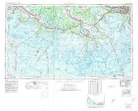
New Orleans, Louisiana, USGS topographic map dated 1963.
Includes geographic coordinates (latitude and longitude). This topographic map is suitable for hiking, camping, and exploring, or framing it as a wall map.
Printed on-demand using high resolution imagery, on heavy weight and acid free paper, or alternatively on a variety of synthetic materials.
Topos available on paper, Waterproof, Poly, or Tyvek. Usually shipping rolled, unless combined with other folded maps in one order.
- Product Number: USGS-5595188
- Free digital map download (high-resolution, GeoPDF): New Orleans, Louisiana (file size: 22 MB)
- Map Size: please refer to the dimensions of the GeoPDF map above
- Weight (paper map): ca. 55 grams
- Map Type: POD USGS Topographic Map
- Map Series: HTMC
- Map Verison: Historical
- Cell ID: 72240
- Scan ID: 335225
- Imprint Year: 1980
- Woodland Tint: Yes
- Aerial Photo Year: 1972
- Edit Year: 1972
- Field Check Year: 1963
- Datum: NAD27
- Map Projection: Transverse Mercator
- Planimetric: Yes
- Map published by United States Army
- Map Language: English
- Scanner Resolution: 600 dpi
- Map Cell Name: New Orleans
- Grid size: 1 X 2 Degree
- Date on map: 1963
- Map Scale: 1:250000
- Geographical region: Louisiana, United States
Neighboring Maps:
All neighboring USGS topo maps are available for sale online at a variety of scales.
Spatial coverage:
Topo map New Orleans, Louisiana, covers the geographical area associated the following places:
- Tabatiere Perdue - Taylors Mobile Home Park - Patterson - Bertie - Marrero - Lower Texas - Boudreaux - Storyville - Munsons - Brule - Leeville - Leche - Laurel Grove Plantation - Boudreaux - Broadmoor - Greenwood - Freetown - Lockport - Ashland - Shadyside - Migues - Faleau (historical) - Olivier - Oaklawn - Thibodaux - Richard - Numa - Avondale - Glenwild - Mobile Home Park - Boeuf - Boutte - Cedar Grove - Violas Mobile Home Park - Lewistown - Albemarle - Lower Garden District - Franklin - Julien - Fairlane - Capri Court Mobile Home Park - Cote Blanche Landing - Hahnville - Central - Lyons - Bourg - Greenwood Acres - Santiague - Bodin - Mandalay - Waverly Mobile Home Park - Patoutville - Linwood - Grandbois - Bayou Boeuf - New Sarpy - Galliano - Argyle - Lasalle - Morgan City - Taft - Matilda - Charlotte - Ollie - Baldwin - South Kenner - Siracusaville - Gloria - Saint Thomas - Little Farms (historical) - Beverly Knoll - Avalon - Bayou Cane - Orlandos Mobile Home Park - Frellsen - Allemand - Lafayette (historical) - Boudreaux's Mobile Home Park - Point Barre - Luling - Live Oak - Bonvillain - Oak Park II Mobile Home Park - Rynella - Bellewood - Hassel's Trailer Park - Plaincourtville - Southdown Plantation - Prevost - Star - Jefferson Heights - Corso - Foley - Metairie Terrace - Oak Alley - Lagan - Ashton - Timberlane - Pierre Part - Batree
- Map Area ID: AREA3029-92-90
- Northwest corner Lat/Long code: USGSNW30-92
- Northeast corner Lat/Long code: USGSNE30-90
- Southwest corner Lat/Long code: USGSSW29-92
- Southeast corner Lat/Long code: USGSSE29-90
- Northern map edge Latitude: 30
- Southern map edge Latitude: 29
- Western map edge Longitude: -92
- Eastern map edge Longitude: -90


