
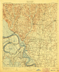
~ Bayou Sara LA topo map, 1:125000 scale, 30 X 30 Minute, Historical, 1906
Bayou Sara, Louisiana, USGS topographic map dated 1906.
Includes geographic coordinates (latitude and longitude). This topographic map is suitable for hiking, camping, and exploring, or framing it as a wall map.
Printed on-demand using high resolution imagery, on heavy weight and acid free paper, or alternatively on a variety of synthetic materials.
Topos available on paper, Waterproof, Poly, or Tyvek. Usually shipping rolled, unless combined with other folded maps in one order.
- Product Number: USGS-5595150
- Free digital map download (high-resolution, GeoPDF): Bayou Sara, Louisiana (file size: 10 MB)
- Map Size: please refer to the dimensions of the GeoPDF map above
- Weight (paper map): ca. 55 grams
- Map Type: POD USGS Topographic Map
- Map Series: HTMC
- Map Verison: Historical
- Cell ID: 64963
- Scan ID: 335202
- Survey Year: 1904
- Datum: Unstated
- Map Projection: Unstated
- Map published by United States Geological Survey
- Map Language: English
- Scanner Resolution: 600 dpi
- Map Cell Name: Bayou Sara
- Grid size: 30 X 30 Minute
- Date on map: 1906
- Map Scale: 1:125000
- Geographical region: Louisiana, United States
Neighboring Maps:
All neighboring USGS topo maps are available for sale online at a variety of scales.
Spatial coverage:
Topo map Bayou Sara, Louisiana, covers the geographical area associated the following places:
- Glenbrook - Whispering Oaks - Granberrys Mobile Home Park - Carney - Morgan Place - Brownsfield - Laurel Hill - North Maryland - Deerford - Patin - Jackson Place - Mengel Landing - Lincoln Heights - Central Estates - Wyatt Subdivision - Ploup - Biltmore - Timberlane - Ambrosia (historical) - Maryland Heights - Forest Park - Forest Glen Estates - Pointe Coupee - Engleswood - Gibbens Place - Twin Oaks - Oscar - Powell - Cunnard Place - Huntley Place - Irene - Erwinville - Carey - Greenwood Estates - Wilcox (historical) - Welcome Heights - Jordan Terrace - Rambling Oaks - McManus - Baker Hills - Comite Hills West - Oak Glen Terrace Mobile Home Park - Torbert - Fred - Spillman - Myrick Place - Beechwood - Southern Heights - Basel (historical) - University Place - Wickliffe - Comite - Olive Branch - Loudon - Morgan Place West - Monterey - Chamberlin - Catalpa (historical) - North Baker Park - Country Estate Acres - East Ridgewood - Plantation Way - Baker - Converse (historical) - Battle - Dude's Trailer Park - Brian Estates - Brooks - Milldale - Crestview Village Mobile Home Park - Sherrington Place - Woodland View - Mickens Place - Woodaire - Sweet Briar Mobile Home Park - Oak Shadows Place - Mount Pleasant - Ventress - Greenwell Acres East - East Fairlane - Bonn - Liberty Farms - Cypress Heights - Pinewood Acres - Rose Hill (historical) - Puckett - Maryland - Central - Glen Oaks Place - Baker Estates - Norwood - Rogillioville - Airline Terrace - Bon Dickey - Leavel - Dugan Landing - Pleasant Hills - Zion City - Hollywood - Alford Acres
- Map Area ID: AREA3130.5-91.5-91
- Northwest corner Lat/Long code: USGSNW31-91.5
- Northeast corner Lat/Long code: USGSNE31-91
- Southwest corner Lat/Long code: USGSSW30.5-91.5
- Southeast corner Lat/Long code: USGSSE30.5-91
- Northern map edge Latitude: 31
- Southern map edge Latitude: 30.5
- Western map edge Longitude: -91.5
- Eastern map edge Longitude: -91


