
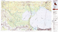
~ Ponchatoula LA topo map, 1:100000 scale, 30 X 60 Minute, Historical, 1983, updated 1984
Ponchatoula, Louisiana, USGS topographic map dated 1983.
Includes geographic coordinates (latitude and longitude). This topographic map is suitable for hiking, camping, and exploring, or framing it as a wall map.
Printed on-demand using high resolution imagery, on heavy weight and acid free paper, or alternatively on a variety of synthetic materials.
Topos available on paper, Waterproof, Poly, or Tyvek. Usually shipping rolled, unless combined with other folded maps in one order.
- Product Number: USGS-5595122
- Free digital map download (high-resolution, GeoPDF): Ponchatoula, Louisiana (file size: 28 MB)
- Map Size: please refer to the dimensions of the GeoPDF map above
- Weight (paper map): ca. 55 grams
- Map Type: POD USGS Topographic Map
- Map Series: HTMC
- Map Verison: Historical
- Cell ID: 68174
- Scan ID: 335187
- Imprint Year: 1984
- Woodland Tint: Yes
- Visual Version Number: 1
- Edit Year: 1983
- Datum: NAD27
- Map Projection: Universal Transverse Mercator
- Map published by United States Geological Survey
- Map Language: English
- Scanner Resolution: 600 dpi
- Map Cell Name: Ponchatoula
- Grid size: 30 X 60 Minute
- Date on map: 1983
- Map Scale: 1:100000
- Geographical region: Louisiana, United States
Neighboring Maps:
All neighboring USGS topo maps are available for sale online at a variety of scales.
Spatial coverage:
Topo map Ponchatoula, Louisiana, covers the geographical area associated the following places:
- Frenchtown Acres - Lakeshore West - Oneida - Lakeshore East - Bissonet Plaza - Akers - Sport - Belmont - Frenier - Hillside Mobile Home Park - Comeaux Mobile Park - Southern Mobile Home Park - Free Town - Donaldsonville - Shady Oaks Mobile Home Park - Marchand - Strader - Hungarian Settlement - Corbin - Chinchuba - Lakeland Estates Mobile Home Park - Haydel (historical) - Carrollwood - Catfish Landing - Pontchartrain Gardens - Johnson - Welcome - Wind Crest Mobile Home Park - Cypress Cove - Burnside - Pine Mobile Home Park - Eden Church Road Mobile Park - Claiborne Hill - Ruddock - Warsaw Landing - Mount Airy - Forstall (historical) - Tigerville - Brittany - Oliver - Willow Grove - Katie (historical) - French Settlement - Rome - Bayou Barbary - Ridgecrest Mobile Home Park - Wallace Landing - Bend - Duke (historical) - Feitel - Dolsen - Bucktown - Eastover Estates Mobile Home Park - Avalon Terrace - Highland Ridge Mobile Home Park - Montz - Lees Landing - Central - Maurepas - Platation Acres - Spanish Fort - Flamingo Recreational Vehicle and Mobile Home Park - S and H Mobile Home Park - Coteau Bourgeois - Burton (historical) - Westgate - Camp Leroy Johnson - Indian Beach - Lockhart - Summerfield - Walker - Bedico - Colomb Park (historical) - Happy Woods - Belle Point - Claybank - Malarcher (historical) - Pontchartrain Beach - North Pass - Ponchatoula - Lake - Shenandoah Estates - Hillaryville - Lewisburg - Head of Island - La Branche - Hobart - Twin Lakes Mobile Estates - Saint Amant - Tilman Park - Welcome - Big D Mobile Home Park - Landon Mobile Home Park - West End - Pate Place - Lemannville - Wheel Estates Mobile Home Park - Bullion - Columbia - White Hall
- Map Area ID: AREA30.530-91-90
- Northwest corner Lat/Long code: USGSNW30.5-91
- Northeast corner Lat/Long code: USGSNE30.5-90
- Southwest corner Lat/Long code: USGSSW30-91
- Southeast corner Lat/Long code: USGSSE30-90
- Northern map edge Latitude: 30.5
- Southern map edge Latitude: 30
- Western map edge Longitude: -91
- Eastern map edge Longitude: -90


