
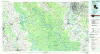
~ Baton Rouge LA topo map, 1:100000 scale, 30 X 60 Minute, Historical, 1984, updated 1984
Baton Rouge, Louisiana, USGS topographic map dated 1984.
Includes geographic coordinates (latitude and longitude). This topographic map is suitable for hiking, camping, and exploring, or framing it as a wall map.
Printed on-demand using high resolution imagery, on heavy weight and acid free paper, or alternatively on a variety of synthetic materials.
Topos available on paper, Waterproof, Poly, or Tyvek. Usually shipping rolled, unless combined with other folded maps in one order.
- Product Number: USGS-5595066
- Free digital map download (high-resolution, GeoPDF): Baton Rouge, Louisiana (file size: 31 MB)
- Map Size: please refer to the dimensions of the GeoPDF map above
- Weight (paper map): ca. 55 grams
- Map Type: POD USGS Topographic Map
- Map Series: HTMC
- Map Verison: Historical
- Cell ID: 67105
- Scan ID: 335157
- Imprint Year: 1984
- Woodland Tint: Yes
- Aerial Photo Year: 1982
- Edit Year: 1984
- Datum: NAD27
- Map Projection: Universal Transverse Mercator
- Map published by United States Geological Survey
- Map Language: English
- Scanner Resolution: 600 dpi
- Map Cell Name: Baton Rouge
- Grid size: 30 X 60 Minute
- Date on map: 1984
- Map Scale: 1:100000
- Geographical region: Louisiana, United States
Neighboring Maps:
All neighboring USGS topo maps are available for sale online at a variety of scales.
Spatial coverage:
Topo map Baton Rouge, Louisiana, covers the geographical area associated the following places:
- Frisco (historical) - Round Oak - Windfall - Highlandia - Jefferson Terrace East - Old Jefferson - Segura - Soulouque - Shenandoah North - University View - Riverland - Bayou Paul - Westdale Heights - Poplar Grove Plantation - Riverside Mobile Home Park - Maxies Mobile Valley - Riverboat Lane Mobile Home Park - Arnaudville - Fairmont - Sardine Point Settlement (historical) - Aubin - Avalon - Queens Row Mobile Home Park - Bruces Mobile Home Park - Frozard - North Sherwood Forest - Hundred Oaks - Windsor Place - Webre - S and R Mobile Home Park - Ulyssee - Plantation Village Mobile Home Park - Champagne - Oak Hills - Villa Del Rey Park - Oak Hill - Rosedale - Orr (historical) - Castlewood - Bluebonnet Ridge - Lakeland Terrace - Hazel (historical) - Chatsworth Acres - Executive Park - Seymourville - Castle Ridge Estates - Antioch Villa - Willow Glen - Pioneer Park - Isle Labbe - Oak Hills Place - Evergreen Plantation - Hillcrest Acres - Blythwood - Catahoula - Woodlawn Estates - Jefferson Terrace - Shenandoah - Sherwood Oaks - T and M Mobile Home Park - Oakcrest - Teche Valley Mobile Home Park - Concord Park - Brookhollow Glen - Camelot - Westdale Terrace - Randolph Heights - Baton Rouge - Crescent - Eden Park - O'Neal Place - Meadow Lea - Longwood - Anchorage - South Highlands - Bankers - Sherwood Forest Mobile Home Park - Choctaw - Iberville Terrace - Sandy's Trailer Park - Modeste - Daspit Mobile Home Park - West Baton Rouge - Shenandoah Park - Jefferson Shadows - South Baton Rouge - Georgetown - Sherwood Oaks South - Belfair - Prescott Court - Broussard - Beacon Hill - Lula - Monterrey Park - Goodwood Estates - Pine Park - Melrose East - Coopersville - Shamrock Gardens - Woodcrest
- Map Area ID: AREA30.530-92-91
- Northwest corner Lat/Long code: USGSNW30.5-92
- Northeast corner Lat/Long code: USGSNE30.5-91
- Southwest corner Lat/Long code: USGSSW30-92
- Southeast corner Lat/Long code: USGSSE30-91
- Northern map edge Latitude: 30.5
- Southern map edge Latitude: 30
- Western map edge Longitude: -92
- Eastern map edge Longitude: -91


