
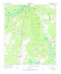
~ Turkey Creek LA topo map, 1:62500 scale, 15 X 15 Minute, Historical, 1967, updated 1969
Turkey Creek, Louisiana, USGS topographic map dated 1967.
Includes geographic coordinates (latitude and longitude). This topographic map is suitable for hiking, camping, and exploring, or framing it as a wall map.
Printed on-demand using high resolution imagery, on heavy weight and acid free paper, or alternatively on a variety of synthetic materials.
Topos available on paper, Waterproof, Poly, or Tyvek. Usually shipping rolled, unless combined with other folded maps in one order.
- Product Number: USGS-5594954
- Free digital map download (high-resolution, GeoPDF): Turkey Creek, Louisiana (file size: 6 MB)
- Map Size: please refer to the dimensions of the GeoPDF map above
- Weight (paper map): ca. 55 grams
- Map Type: POD USGS Topographic Map
- Map Series: HTMC
- Map Verison: Historical
- Cell ID: 63755
- Scan ID: 335088
- Imprint Year: 1969
- Woodland Tint: Yes
- Datum: NAD27
- Map Projection: Polyconic
- Map published by United States Geological Survey
- Map Language: English
- Scanner Resolution: 600 dpi
- Map Cell Name: Turkey Creek
- Grid size: 15 X 15 Minute
- Date on map: 1967
- Map Scale: 1:62500
- Geographical region: Louisiana, United States
Neighboring Maps:
All neighboring USGS topo maps are available for sale online at a variety of scales.
Spatial coverage:
Topo map Turkey Creek, Louisiana, covers the geographical area associated the following places:
- Haas - Saint Landry - Centerville - Bennett Bay Landing - Nobrac - Lone Pine - Clarks Landing - Dove Landing - Squealer Point Landing - Easton - Meridian - Omo (historical) - Bayou Chicot - Belle Chaney (historical) - Pine Prairie - Clubhouse Landing - Turkey Creek - Beale - Lake Cove - Johnson Landing - Stewart (historical) - Hester Landing - Blue Lake Landing - Clearwater - Dossman
- Map Area ID: AREA3130.75-92.5-92.25
- Northwest corner Lat/Long code: USGSNW31-92.5
- Northeast corner Lat/Long code: USGSNE31-92.25
- Southwest corner Lat/Long code: USGSSW30.75-92.5
- Southeast corner Lat/Long code: USGSSE30.75-92.25
- Northern map edge Latitude: 31
- Southern map edge Latitude: 30.75
- Western map edge Longitude: -92.5
- Eastern map edge Longitude: -92.25


