
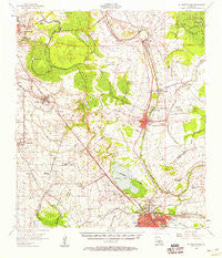
~ St Martinville LA topo map, 1:62500 scale, 15 X 15 Minute, Historical, 1957, updated 1958
St Martinville, Louisiana, USGS topographic map dated 1957.
Includes geographic coordinates (latitude and longitude). This topographic map is suitable for hiking, camping, and exploring, or framing it as a wall map.
Printed on-demand using high resolution imagery, on heavy weight and acid free paper, or alternatively on a variety of synthetic materials.
Topos available on paper, Waterproof, Poly, or Tyvek. Usually shipping rolled, unless combined with other folded maps in one order.
- Product Number: USGS-5594876
- Free digital map download (high-resolution, GeoPDF): St Martinville, Louisiana (file size: 8 MB)
- Map Size: please refer to the dimensions of the GeoPDF map above
- Weight (paper map): ca. 55 grams
- Map Type: POD USGS Topographic Map
- Map Series: HTMC
- Map Verison: Historical
- Cell ID: 61954
- Scan ID: 335040
- Imprint Year: 1958
- Woodland Tint: Yes
- Aerial Photo Year: 1951
- Survey Year: 1957
- Datum: NAD27
- Map Projection: Polyconic
- Map published by United States Geological Survey
- Map published by United States Army Corps of Engineers
- Map Language: English
- Scanner Resolution: 600 dpi
- Map Cell Name: Saint Martinville
- Grid size: 15 X 15 Minute
- Date on map: 1957
- Map Scale: 1:62500
- Geographical region: Louisiana, United States
Neighboring Maps:
All neighboring USGS topo maps are available for sale online at a variety of scales.
Spatial coverage:
Topo map St Martinville, Louisiana, covers the geographical area associated the following places:
- Capitan - Oliva Mobile Home Park - Miguez Mobile Home Park - Segura - Youngsville - Pilette - Twisted Oaks Mobile Park - Isle Labbe - Morbihan - Keystone - Saint John - Ulyssee - Long Bridge - Belle Place Trailer Park - Thibodeaux Mobile Home Park - Daspit Mobile Home Park - Teche Valley Mobile Home Park - Delacroix - Broussard - Anite Mobile Home Park - Parks - Cinco (historical) - Levert - T and M Mobile Home Park - Lozes - Hazel (historical) - Cajun Country Mobile Home Park - Walroy - Larabee - Bruces Mobile Home Park - Ruth - New Iberia - Georgetown - Maxies Mobile Valley - Billeaud - Midway Mobile Park - Coopersville - New Horizon Mobile Home Park - Plantation Village Mobile Home Park - Coteau - Banker Plantation - Azema (historical) - Leesburg - Gauthier (historical) - Crepe Myrtle Mobile Home Park - Saint Martinville - Elks - Mouton's Trailer Park - Duchamp - Romero - Cade - Queens Row Mobile Home Park - Independent - Landry (historical) - Daspit - Sumerall - Westland Mobile Home Park - Burke - Kiper Mobile Home Park
- Map Area ID: AREA30.2530-92-91.75
- Northwest corner Lat/Long code: USGSNW30.25-92
- Northeast corner Lat/Long code: USGSNE30.25-91.75
- Southwest corner Lat/Long code: USGSSW30-92
- Southeast corner Lat/Long code: USGSSE30-91.75
- Northern map edge Latitude: 30.25
- Southern map edge Latitude: 30
- Western map edge Longitude: -92
- Eastern map edge Longitude: -91.75


