
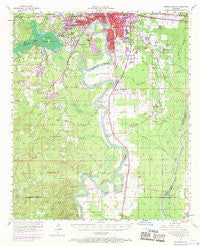
~ Monroe South LA topo map, 1:62500 scale, 15 X 15 Minute, Historical, 1957, updated 1970
Monroe South, Louisiana, USGS topographic map dated 1957.
Includes geographic coordinates (latitude and longitude). This topographic map is suitable for hiking, camping, and exploring, or framing it as a wall map.
Printed on-demand using high resolution imagery, on heavy weight and acid free paper, or alternatively on a variety of synthetic materials.
Topos available on paper, Waterproof, Poly, or Tyvek. Usually shipping rolled, unless combined with other folded maps in one order.
- Product Number: USGS-5594482
- Free digital map download (high-resolution, GeoPDF): Monroe South, Louisiana (file size: 7 MB)
- Map Size: please refer to the dimensions of the GeoPDF map above
- Weight (paper map): ca. 55 grams
- Map Type: POD USGS Topographic Map
- Map Series: HTMC
- Map Verison: Historical
- Cell ID: 57793
- Scan ID: 334813
- Imprint Year: 1970
- Woodland Tint: Yes
- Photo Revision Year: 1969
- Aerial Photo Year: 1969
- Survey Year: 1957
- Datum: NAD27
- Map Projection: Polyconic
- Map published by United States Geological Survey
- Map Language: English
- Scanner Resolution: 600 dpi
- Map Cell Name: Monroe South
- Grid size: 15 X 15 Minute
- Date on map: 1957
- Map Scale: 1:62500
- Geographical region: Louisiana, United States
Neighboring Maps:
All neighboring USGS topo maps are available for sale online at a variety of scales.
Spatial coverage:
Topo map Monroe South, Louisiana, covers the geographical area associated the following places:
- Brownsville - Green Terrace - Pino Bayou Village - Lincoln Park - Wilds - Garden Park - East Parkview - Maidco - Charmingdale - Pine Grove - Cypress - McLain - Westwood - Sunnybrook Farms - Steven - Summit - Bawcomville - Myatt (historical) - Ridgecrest - Rilla - Filhiol - Cuba - Robinson Place - Cobb - Kings Oaks - Tanglewood - Southwinds - Lenwil - Huntington Park - Bosco - De Loach - Siegle - Logtown - Magenta - Erco - Richwood - Fondale - West Heights - Forest Oaks - Luna
- Map Area ID: AREA32.532.25-92.25-92
- Northwest corner Lat/Long code: USGSNW32.5-92.25
- Northeast corner Lat/Long code: USGSNE32.5-92
- Southwest corner Lat/Long code: USGSSW32.25-92.25
- Southeast corner Lat/Long code: USGSSE32.25-92
- Northern map edge Latitude: 32.5
- Southern map edge Latitude: 32.25
- Western map edge Longitude: -92.25
- Eastern map edge Longitude: -92


