
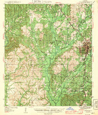
~ Leesville LA topo map, 1:62500 scale, 15 X 15 Minute, Historical, 1943
Leesville, Louisiana, USGS topographic map dated 1943.
Includes geographic coordinates (latitude and longitude). This topographic map is suitable for hiking, camping, and exploring, or framing it as a wall map.
Printed on-demand using high resolution imagery, on heavy weight and acid free paper, or alternatively on a variety of synthetic materials.
Topos available on paper, Waterproof, Poly, or Tyvek. Usually shipping rolled, unless combined with other folded maps in one order.
- Product Number: USGS-5594372
- Free digital map download (high-resolution, GeoPDF): Leesville, Louisiana (file size: 9 MB)
- Map Size: please refer to the dimensions of the GeoPDF map above
- Weight (paper map): ca. 55 grams
- Map Type: POD USGS Topographic Map
- Map Series: HTMC
- Map Verison: Historical
- Cell ID: 56640
- Scan ID: 334748
- Woodland Tint: Yes
- Survey Year: 1942
- Datum: NAD27
- Map Projection: Polyconic
- Map published by United States Geological Survey
- Map Language: English
- Scanner Resolution: 600 dpi
- Map Cell Name: Leesville
- Grid size: 15 X 15 Minute
- Date on map: 1943
- Map Scale: 1:62500
- Geographical region: Louisiana, United States
Neighboring Maps:
All neighboring USGS topo maps are available for sale online at a variety of scales.
Spatial coverage:
Topo map Leesville, Louisiana, covers the geographical area associated the following places:
- Dixie - Whispering Pines Estates - South End - Tower Trailer Park - Pinecrest - Leesville - Elmwood - Lincoln Heights - Tower Estates Number 2 - Frank Bell Subdivision - McFarland Heights - Powell Park - Caney - Fertitta Park - Standard - West Side - Pickering - Savage Fork - Morris Addition - Billy Goat Hill - Hawthorne - Lee Hills - Allendale - Woodlands - Coopers - Tower Estates Number 1 - Kimberly Heights - Chateau Place - Burr Ferry - West End - New Llano - Lyles Addition - Westwood Village - East Side
- Map Area ID: AREA31.2531-93.5-93.25
- Northwest corner Lat/Long code: USGSNW31.25-93.5
- Northeast corner Lat/Long code: USGSNE31.25-93.25
- Southwest corner Lat/Long code: USGSSW31-93.5
- Southeast corner Lat/Long code: USGSSE31-93.25
- Northern map edge Latitude: 31.25
- Southern map edge Latitude: 31
- Western map edge Longitude: -93.5
- Eastern map edge Longitude: -93.25


