
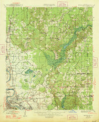
~ Bossier City LA topo map, 1:62500 scale, 15 X 15 Minute, Historical, 1948
Bossier City, Louisiana, USGS topographic map dated 1948.
Includes geographic coordinates (latitude and longitude). This topographic map is suitable for hiking, camping, and exploring, or framing it as a wall map.
Printed on-demand using high resolution imagery, on heavy weight and acid free paper, or alternatively on a variety of synthetic materials.
Topos available on paper, Waterproof, Poly, or Tyvek. Usually shipping rolled, unless combined with other folded maps in one order.
- Product Number: USGS-5593628
- Free digital map download (high-resolution, GeoPDF): Bossier City, Louisiana (file size: 8 MB)
- Map Size: please refer to the dimensions of the GeoPDF map above
- Weight (paper map): ca. 55 grams
- Map Type: POD USGS Topographic Map
- Map Series: HTMC
- Map Verison: Historical
- Cell ID: 51658
- Scan ID: 334305
- Woodland Tint: Yes
- Datum: NAD27
- Map Projection: Polyconic
- Map published by United States Geological Survey
- Map Language: English
- Scanner Resolution: 600 dpi
- Map Cell Name: Bossier City
- Grid size: 15 X 15 Minute
- Date on map: 1948
- Map Scale: 1:62500
- Geographical region: Louisiana, United States
Neighboring Maps:
All neighboring USGS topo maps are available for sale online at a variety of scales.
Spatial coverage:
Topo map Bossier City, Louisiana, covers the geographical area associated the following places:
- Dukedale - Ferguson - Brookhaven Estates - Fillmore - Linton - Brownlee - Dogwood Forest - Espanita Forest - Barso - Honore - Hinkle - Mimosa Gardens - Oak Thicket Acres - Airline Park Estates - Happy Meadows - Greenacres Place - Red Chute - Fosters - Southern Terrace - Whitehurst - Waller - Adner - Dogwood Park - Dogwood Estates - Glendale - Vanceville - Shady Park - Willow Chute - Bellevue - Holly Ridge - Crestwood Heights - Cloverdale - Dogwood Hills - Bodcau - Tall Timbers - Dogwood Acres - Bossier City - Coleman Park - Carriage Oaks - Green Acres - Swan Lake - Country Place - Princeton - Haughton - Bodcau Park - Merrywoods - Benton - Morris - Espanita Village - Eastwood - Wafer Forest - Parkland Village - Meadowview Park - Midway - South Merrywoods - Brownlee Estates
- Map Area ID: AREA32.7532.5-93.75-93.5
- Northwest corner Lat/Long code: USGSNW32.75-93.75
- Northeast corner Lat/Long code: USGSNE32.75-93.5
- Southwest corner Lat/Long code: USGSSW32.5-93.75
- Southeast corner Lat/Long code: USGSSE32.5-93.5
- Northern map edge Latitude: 32.75
- Southern map edge Latitude: 32.5
- Western map edge Longitude: -93.75
- Eastern map edge Longitude: -93.5


