
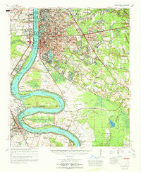
~ Baton Rouge LA topo map, 1:62500 scale, 15 X 15 Minute, Historical, 1965, updated 1965
Baton Rouge, Louisiana, USGS topographic map dated 1965.
Includes geographic coordinates (latitude and longitude). This topographic map is suitable for hiking, camping, and exploring, or framing it as a wall map.
Printed on-demand using high resolution imagery, on heavy weight and acid free paper, or alternatively on a variety of synthetic materials.
Topos available on paper, Waterproof, Poly, or Tyvek. Usually shipping rolled, unless combined with other folded maps in one order.
- Product Number: USGS-5593550
- Free digital map download (high-resolution, GeoPDF): Baton Rouge, Louisiana (file size: 10 MB)
- Map Size: please refer to the dimensions of the GeoPDF map above
- Weight (paper map): ca. 55 grams
- Map Type: POD USGS Topographic Map
- Map Series: HTMC
- Map Verison: Historical
- Cell ID: 51010
- Scan ID: 334255
- Imprint Year: 1965
- Woodland Tint: Yes
- Aerial Photo Year: 1962
- Datum: NAD27
- Map Projection: Polyconic
- Map published by United States Army Corps of Engineers
- Map Language: English
- Scanner Resolution: 600 dpi
- Map Cell Name: Baton Rouge
- Grid size: 15 X 15 Minute
- Date on map: 1965
- Map Scale: 1:62500
- Geographical region: Louisiana, United States
Neighboring Maps:
All neighboring USGS topo maps are available for sale online at a variety of scales.
Spatial coverage:
Topo map Baton Rouge, Louisiana, covers the geographical area associated the following places:
- McGrath Heights - Partridge Lane Heights - Park Forest East - Villa Del Rey - Steele Place - Independence Place - Bayou Fountain - Beauregard Town - Castille - Poplar Grove Plantation - Brightside Park - University Gardens - West Sherwood Forest - Forest Hill - Stafford Place - Port Allen - South Baton Rouge - Parkview East - Kenilworth - Pollard Estates - Shenandoah Park - Woodlawn Acres - North Red Oaks - Tara - Audubon Terrace - Capitol View - Fairmont - Beaulieu - Plaquemine - The Highlands - Mirabeau Gardens - Oak Park - Bell Grove Place - Meadow Park - Port Allen Landing - Pioneer Park - Stevendale Park - Ben Hur (historical) - Seymourville - Brookstown - Essen Plaza - Country Road - College Park - Frisco (historical) - East Broadmoor - Moreland - Broadmoor Plaza - Swart - Magellan Place - Parkview Oaks - Centurion Place - Stevendale Heights - Orr (historical) - Smiley Heights - Broussard Landing - Highland Crossing - Magnolia Terrace - Briarcliff - Essen South - Millerville - Concord Estates - Prescott Court - Maribel Village - Magnolia Woods - Courtland Place - Aubin - Antonio - Avalon - Oakbrook - Walden - Village Cote - Shiloh - Magnolia Heights - Shadowbrook - Iberville Terrace - Myrtle Grove - Rhodes - Shenandoah Square - Night Recreational Vehicle Park - Hillside - South Highlands - South Broadmoor - Tigerland Acres - Greenwell Forest - Willow Glen - Ardenwood - Walnut Hill - Victoria Farm - Stevensdale - Goodwood - Sable Chase - Saint James - McLemore Acres - Broadmoor Estates - Lafitte Hill - Brousard Plaza - Broadmoor Place - Bristol - Normandy Acres - Sweetbriar
- Map Area ID: AREA30.530.25-91.25-91
- Northwest corner Lat/Long code: USGSNW30.5-91.25
- Northeast corner Lat/Long code: USGSNE30.5-91
- Southwest corner Lat/Long code: USGSSW30.25-91.25
- Southeast corner Lat/Long code: USGSSE30.25-91
- Northern map edge Latitude: 30.5
- Southern map edge Latitude: 30.25
- Western map edge Longitude: -91.25
- Eastern map edge Longitude: -91


