
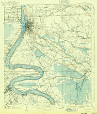
~ Baton Rouge LA topo map, 1:62500 scale, 15 X 15 Minute, Historical, 1908, updated 1943
Baton Rouge, Louisiana, USGS topographic map dated 1908.
Includes geographic coordinates (latitude and longitude). This topographic map is suitable for hiking, camping, and exploring, or framing it as a wall map.
Printed on-demand using high resolution imagery, on heavy weight and acid free paper, or alternatively on a variety of synthetic materials.
Topos available on paper, Waterproof, Poly, or Tyvek. Usually shipping rolled, unless combined with other folded maps in one order.
- Product Number: USGS-5593544
- Free digital map download (high-resolution, GeoPDF): Baton Rouge, Louisiana (file size: 8 MB)
- Map Size: please refer to the dimensions of the GeoPDF map above
- Weight (paper map): ca. 55 grams
- Map Type: POD USGS Topographic Map
- Map Series: HTMC
- Map Verison: Historical
- Cell ID: 51010
- Scan ID: 334252
- Imprint Year: 1943
- Woodland Tint: Yes
- Survey Year: 1906
- Datum: Unstated
- Map Projection: Polyconic
- Map published by United States Geological Survey
- Map Language: English
- Scanner Resolution: 600 dpi
- Map Cell Name: Baton Rouge
- Grid size: 15 X 15 Minute
- Date on map: 1908
- Map Scale: 1:62500
- Geographical region: Louisiana, United States
Neighboring Maps:
All neighboring USGS topo maps are available for sale online at a variety of scales.
Spatial coverage:
Topo map Baton Rouge, Louisiana, covers the geographical area associated the following places:
- Parkland Terrace - Brookhollow Glen - Airline Acres - Del Rey Plaza - Lukeville - South Baton Rouge - Victoria Farm - Longwood - Magnolia Woods - Essen South - Antioch Villa - Burden Estates - Morning Glen - Parkview Oaks - University Acres - South River Oaks - Riffel Place - West Sherwood Forest - Baton Rouge Terrace - College Hills - Perkins Place - Palm Hills - Collegetown - Kleinert - Sarasota Place - Reveille - Stanford Place - Sherwood Manor - Kings Hill - Lakecrest - Lakeland Terrace - The Shire - Ardenwood - Bird - Anchorage - Dent Terrace - Inniswold Estates - West River Oaks - Autumn Run - Fairwoods - Mayfair Park - Forest Hill - Evergreen Plantation - Goodwood - Acadian Place - Myrtle Grove - University View - Florida Plaza - Longwood Court - Walden - Fairmont - Broussard Landing - Beacon Hill - Normandy Acres - Beauregard Town - Antonio - Essen - Greenway Place - Monterrey Park - Wellington - Highland Road Estates - Bernard Terrace - Siegen - Red Oak - Parkview East - Hyacinth Terrace - Bell Grove Place - Istrouma - Lakeside - Stevensdale - Sardine Point Settlement (historical) - Shiloh - Brandon Hollow - Briarcliff - Pine Park - South Highlands - Capitol View - Oak Park - Executive Park - Walnut Hill - Court Street Estates Mobile Home Park - Sunshine - Darius Place - Magnolia Terrace - Pecue Mobile Home Park - Eliza - Tara - Broadmoor Place - Perkins Village - Randolph Heights - South Highland - Silverside - Highland Creek - Oakcrest - Baton Rouge - Hillside - Broadmoor Plaza - Saint Louis - University Shadows - Villa Del Rey Park
- Map Area ID: AREA30.530.25-91.25-91
- Northwest corner Lat/Long code: USGSNW30.5-91.25
- Northeast corner Lat/Long code: USGSNE30.5-91
- Southwest corner Lat/Long code: USGSSW30.25-91.25
- Southeast corner Lat/Long code: USGSSE30.25-91
- Northern map edge Latitude: 30.5
- Southern map edge Latitude: 30.25
- Western map edge Longitude: -91.25
- Eastern map edge Longitude: -91


