
~ Redfish Point NW LA topo map, 1:31680 scale, 7.5 X 7.5 Minute, Historical, 1954, updated 1954
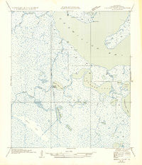
Redfish Point NW, Louisiana, USGS topographic map dated 1954.
Includes geographic coordinates (latitude and longitude). This topographic map is suitable for hiking, camping, and exploring, or framing it as a wall map.
Printed on-demand using high resolution imagery, on heavy weight and acid free paper, or alternatively on a variety of synthetic materials.
Topos available on paper, Waterproof, Poly, or Tyvek. Usually shipping rolled, unless combined with other folded maps in one order.
- Product Number: USGS-5593270
- Free digital map download (high-resolution, GeoPDF): Redfish Point NW, Louisiana (file size: 5 MB)
- Map Size: please refer to the dimensions of the GeoPDF map above
- Weight (paper map): ca. 55 grams
- Map Type: POD USGS Topographic Map
- Map Series: HTMC
- Map Verison: Historical
- Cell ID: 15107
- Scan ID: 334067
- Imprint Year: 1954
- Field Check Year: 1932
- Datum: NAD27
- Map Projection: Polyconic
- Advance: Yes
- Planimetric: Yes
- Map published by United States Geological Survey
- Map Language: English
- Scanner Resolution: 600 dpi
- Map Cell Name: Fearman Lake
- Grid size: 7.5 X 7.5 Minute
- Date on map: 1954
- Map Scale: 1:31680
- Geographical region: Louisiana, United States
Neighboring Maps:
All neighboring USGS topo maps are available for sale online at a variety of scales.
Spatial coverage:
Topo map Redfish Point NW, Louisiana, covers the geographical area associated the following places:
- Big Island Bayou - Big Island Lakes - Toms Bayou - North Lake - Hog Lake - East Buck Point Gas Field - Charles Bayou - Buck Point - Mud Point - Bob Lake - Bayou Fearman - Onemile Bayou - Belle Isle Bayou - South Lake - West Cheniere Au Tigre Canal - Parish Governing Authority District 9 - Nicks Lake - Deepwater Bayou - Sixmile Canal - Teal Ponds - Coles Bayou - Belle Isle - Belle Isle Lake - Lake Toms - Buck Point Gas Field - Bayou Prien - Belle Isle Canal - Coot Lake - Little Bayou Chene - Deep Lake - Shallow Bayou - Fearman Lake
- Map Area ID: AREA29.7529.625-92.25-92.125
- Northwest corner Lat/Long code: USGSNW29.75-92.25
- Northeast corner Lat/Long code: USGSNE29.75-92.125
- Southwest corner Lat/Long code: USGSSW29.625-92.25
- Southeast corner Lat/Long code: USGSSE29.625-92.125
- Northern map edge Latitude: 29.75
- Southern map edge Latitude: 29.625
- Western map edge Longitude: -92.25
- Eastern map edge Longitude: -92.125


