
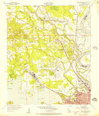
~ North Shreveport LA topo map, 1:24000 scale, 7.5 X 7.5 Minute, Historical, 1955, updated 1956
North Shreveport, Louisiana, USGS topographic map dated 1955.
Includes geographic coordinates (latitude and longitude). This topographic map is suitable for hiking, camping, and exploring, or framing it as a wall map.
Printed on-demand using high resolution imagery, on heavy weight and acid free paper, or alternatively on a variety of synthetic materials.
Topos available on paper, Waterproof, Poly, or Tyvek. Usually shipping rolled, unless combined with other folded maps in one order.
- Product Number: USGS-5591280
- Free digital map download (high-resolution, GeoPDF): North Shreveport, Louisiana (file size: 11 MB)
- Map Size: please refer to the dimensions of the GeoPDF map above
- Weight (paper map): ca. 55 grams
- Map Type: POD USGS Topographic Map
- Map Series: HTMC
- Map Verison: Historical
- Cell ID: 32378
- Scan ID: 332956
- Imprint Year: 1956
- Woodland Tint: Yes
- Survey Year: 1955
- Datum: NAD27
- Map Projection: Polyconic
- Map published by United States Geological Survey
- Map published by United States Army Corps of Engineers
- Map Language: English
- Scanner Resolution: 600 dpi
- Map Cell Name: North Highlands
- Grid size: 7.5 X 7.5 Minute
- Date on map: 1955
- Map Scale: 1:24000
- Geographical region: Louisiana, United States
Neighboring Maps:
All neighboring USGS topo maps are available for sale online at a variety of scales.
Spatial coverage:
Topo map North Shreveport, Louisiana, covers the geographical area associated the following places:
- Shreveport - Lakeview - Cash Point - Dorian Terrace - Pine Hill Estates - Good Roads - Audrey Park - Northwoods - Lakeside Acres - One North Place - Conn - Cooper Road - North Shreveport - Gas Center - Albany (historical) - North Highlands - Indian Hills Estates - Hanna Park - Highland Square
- Map Area ID: AREA32.62532.5-93.875-93.75
- Northwest corner Lat/Long code: USGSNW32.625-93.875
- Northeast corner Lat/Long code: USGSNE32.625-93.75
- Southwest corner Lat/Long code: USGSSW32.5-93.875
- Southeast corner Lat/Long code: USGSSE32.5-93.75
- Northern map edge Latitude: 32.625
- Southern map edge Latitude: 32.5
- Western map edge Longitude: -93.875
- Eastern map edge Longitude: -93.75


