
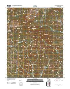
~ Gainesville NW MO topo map, 1:24000 scale, 7.5 X 7.5 Minute, Historical, 2012
Gainesville NW, Missouri, USGS topographic map dated 2012.
Includes geographic coordinates (latitude and longitude). This topographic map is suitable for hiking, camping, and exploring, or framing it as a wall map.
Printed on-demand using high resolution imagery, on heavy weight and acid free paper, or alternatively on a variety of synthetic materials.
Topos available on paper, Waterproof, Poly, or Tyvek. Usually shipping rolled, unless combined with other folded maps in one order.
- Product Number: USGS-5587716
- Free digital map download (high-resolution, GeoPDF): Gainesville NW, Missouri (file size: 26 MB)
- Map Size: please refer to the dimensions of the GeoPDF map above
- Weight (paper map): ca. 55 grams
- Map Type: POD USGS Topographic Map
- Map Series: US Topo
- Map Verison: Historical
- Cell ID: 16650
- Datum: North American Datum of 1983
- Map Projection: Transverse Mercator
- Map Cell Name: Gainesville NW
- Grid size: 7.5 X 7.5 Minute
- Date on map: 2012
- Map Scale: 1:24000
- Geographical region: Missouri, United States
Neighboring Maps:
All neighboring USGS topo maps are available for sale online at a variety of scales.
Spatial coverage:
Topo map Gainesville NW, Missouri, covers the geographical area associated the following places:
- Upper Brixey School (historical) - Double Head Knob - Long Bald - Sheppard Ridge - Board Hollow - Little Pinnacle - Preston Flat Ridge - Grisham Hollow - Mud Spring Hollow - Duke Hollow - Long Mountain - Mallow Lake Dam - Sam Hollow - Nebraska School - Pine Knob - Pinnacle - Gardner Lake - Herd Lake - Caney Mount Volunteer Fire Department - High Rock Mountain - Vince Knob - Smith Spring Hollow - Evening Shade School (historical) - Pineview School (historical) - Road Knobs - Brushy Knob - Bryant Volunteer Fire Department - Mineral Hill - Stony Knob - Brushy Knob School (historical) - Stillhouse Hollow - Deer Lick Point - Little Stony Knob - Fields Hollow - Cedar Hollow - Romance Lookout Tower - Cooper Hollow - Sheppard Cemetery - Finley Hollow - Tater Cave Mountain - Township of Barren Fork - Pineview Church - Ozark County - Mailroute Hollow - Kinman Knob - Elliot Hollow - Bear Cave Mountain - Mallow Lake - Glade Knob - Ludecker Bald - Board Hollow - Brushy Knob Cemetery - Herd Dam - Cap Knob - Simmons Ridge - Brushy Knob Church - Landers Hollow - Caney Mountain - Caney Mountain State Game Refuge - Timber Knob - Gardner Dam
- Map Area ID: AREA36.7536.625-92.5-92.375
- Northwest corner Lat/Long code: USGSNW36.75-92.5
- Northeast corner Lat/Long code: USGSNE36.75-92.375
- Southwest corner Lat/Long code: USGSSW36.625-92.5
- Southeast corner Lat/Long code: USGSSE36.625-92.375
- Northern map edge Latitude: 36.75
- Southern map edge Latitude: 36.625
- Western map edge Longitude: -92.5
- Eastern map edge Longitude: -92.375


