
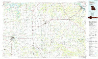
~ Mexico MO topo map, 1:100000 scale, 30 X 60 Minute, Historical, 1986, updated 1986
Mexico, Missouri, USGS topographic map dated 1986.
Includes geographic coordinates (latitude and longitude). This topographic map is suitable for hiking, camping, and exploring, or framing it as a wall map.
Printed on-demand using high resolution imagery, on heavy weight and acid free paper, or alternatively on a variety of synthetic materials.
Topos available on paper, Waterproof, Poly, or Tyvek. Usually shipping rolled, unless combined with other folded maps in one order.
- Product Number: USGS-5575472
- Free digital map download (high-resolution, GeoPDF): Mexico, Missouri (file size: 20 MB)
- Map Size: please refer to the dimensions of the GeoPDF map above
- Weight (paper map): ca. 55 grams
- Map Type: POD USGS Topographic Map
- Map Series: HTMC
- Map Verison: Historical
- Cell ID: 67948
- Scan ID: 325382
- Imprint Year: 1986
- Woodland Tint: Yes
- Aerial Photo Year: 1984
- Edit Year: 1986
- Datum: NAD27
- Map Projection: Universal Transverse Mercator
- Planimetric: Yes
- Map published by United States Geological Survey
- Map Language: English
- Scanner Resolution: 600 dpi
- Map Cell Name: Mexico
- Grid size: 30 X 60 Minute
- Date on map: 1986
- Map Scale: 1:100000
- Geographical region: Missouri, United States
Neighboring Maps:
All neighboring USGS topo maps are available for sale online at a variety of scales.
Spatial coverage:
Topo map Mexico, Missouri, covers the geographical area associated the following places:
- McCune - Louisville - Mashek (historical) - Cyrene - Hopkinsville - Middletown - Louisiana - New Harmony - Eolia - Concord - Millwood - Marling - Curryville - Skinner - Stepanek Crossing - Mackville - Farber - Edgewood - Olney - Frankford - Culiver - Gamma - Champ - Briscoe - Silex - Stark - Spencerburg - Molino - Stillhouse Ford - Reading - Calumet - Shamrock - Wellsville - Estes - Benton City - Farmer - Bellflower - Mexico - Moores (historical) - Hollensville - New Hartford - Cave - Famous - Worcester - Hobart - Vandiver - Florida - Hickory Creek (historical) - Greenlawn - Elmwood - Strother - Pike - Ashley - Bryans (historical) - Santa Fe - Whiteside - Corso - Davis - Madisonville - Thompson - Bassinger Corner - Buzzards Roost - Perry - Buell - Gazette - Vera - West Hartford - Tarrants - Saint Clement - Vandalia - Truxton - Fairview - Laddonia - Rices Corner - Auxvasse - Hutchison - Quincy Junction - Ortiz (historical) - Scotts Corner - Martinsburg - Rush Hill - Victor - Bowling Green
- Map Area ID: AREA39.539-92-91
- Northwest corner Lat/Long code: USGSNW39.5-92
- Northeast corner Lat/Long code: USGSNE39.5-91
- Southwest corner Lat/Long code: USGSSW39-92
- Southeast corner Lat/Long code: USGSSE39-91
- Northern map edge Latitude: 39.5
- Southern map edge Latitude: 39
- Western map edge Longitude: -92
- Eastern map edge Longitude: -91


