
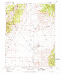
~ Spencer Hot Springs NV topo map, 1:62500 scale, 15 X 15 Minute, Historical, 1960, updated 1968
Spencer Hot Springs, Nevada, USGS topographic map dated 1960.
Includes geographic coordinates (latitude and longitude). This topographic map is suitable for hiking, camping, and exploring, or framing it as a wall map.
Printed on-demand using high resolution imagery, on heavy weight and acid free paper, or alternatively on a variety of synthetic materials.
Topos available on paper, Waterproof, Poly, or Tyvek. Usually shipping rolled, unless combined with other folded maps in one order.
- Product Number: USGS-5573202
- Free digital map download (high-resolution, GeoPDF): Spencer Hot Springs, Nevada (file size: 7 MB)
- Map Size: please refer to the dimensions of the GeoPDF map above
- Weight (paper map): ca. 55 grams
- Map Type: POD USGS Topographic Map
- Map Series: HTMC
- Map Verison: Historical
- Cell ID: 62834
- Scan ID: 321318
- Imprint Year: 1968
- Woodland Tint: Yes
- Aerial Photo Year: 1956
- Survey Year: 1960
- Datum: NAD27
- Map Projection: Polyconic
- Map published by United States Geological Survey
- Map Language: English
- Scanner Resolution: 600 dpi
- Map Cell Name: Spencer Hot Springs
- Grid size: 15 X 15 Minute
- Date on map: 1960
- Map Scale: 1:62500
- Geographical region: Nevada, United States
Neighboring Maps:
All neighboring USGS topo maps are available for sale online at a variety of scales.
Spatial coverage:
Topo map Spencer Hot Springs, Nevada, covers the geographical area associated the following places:
- Goodyear Spring - Spencer Hot Springs - Lower Reeder Spring - Bob Scott Forest Service Recreation Site - Blackbird - Lowboy Mine - Ackerman Spring - Lynch Creek - Windlass Spring - Conquest Mine - Linka Mine - Petes Well - Blackbird Creek - Givens Ranch - Blackbird Ranch - Birch Creek Ranch - Birch Creek Mine - Frontier - Tar Creek - Spencers Hot Springs Mining District - Petes Canyon - Deerings Ranch - Laborde Ranch - Bob Scotts Historical Site - Simpson Park Canyon - Reeder Spring - Bob Scotts Summit - Hickison Petroglyth Recreation Site - Rye Patch Canyon - Rutheford Canyon - Black Bird Canyon - Cape Horn - Cape Horn Overland Stage Station - Blackbird Spring
- Map Area ID: AREA39.539.25-117-116.75
- Northwest corner Lat/Long code: USGSNW39.5-117
- Northeast corner Lat/Long code: USGSNE39.5-116.75
- Southwest corner Lat/Long code: USGSSW39.25-117
- Southeast corner Lat/Long code: USGSSE39.25-116.75
- Northern map edge Latitude: 39.5
- Southern map edge Latitude: 39.25
- Western map edge Longitude: -117
- Eastern map edge Longitude: -116.75


