
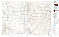
~ Norfolk NE topo map, 1:100000 scale, 30 X 60 Minute, Historical, 1985, updated 1991
Norfolk, Nebraska, USGS topographic map dated 1985.
Includes geographic coordinates (latitude and longitude). This topographic map is suitable for hiking, camping, and exploring, or framing it as a wall map.
Printed on-demand using high resolution imagery, on heavy weight and acid free paper, or alternatively on a variety of synthetic materials.
Topos available on paper, Waterproof, Poly, or Tyvek. Usually shipping rolled, unless combined with other folded maps in one order.
- Product Number: USGS-5563734
- Free digital map download (high-resolution, GeoPDF): Norfolk, Nebraska (file size: 26 MB)
- Map Size: please refer to the dimensions of the GeoPDF map above
- Weight (paper map): ca. 55 grams
- Map Type: POD USGS Topographic Map
- Map Series: HTMC
- Map Verison: Historical
- Cell ID: 68059
- Scan ID: 317751
- Imprint Year: 1991
- Woodland Tint: Yes
- Photo Inspection Year: 1988
- Aerial Photo Year: 1988
- Edit Year: 1985
- Datum: NAD27
- Map Projection: Universal Transverse Mercator
- Map published by United States Geological Survey
- Map Language: English
- Scanner Resolution: 600 dpi
- Map Cell Name: Norfolk
- Grid size: 30 X 60 Minute
- Date on map: 1985
- Map Scale: 1:100000
- Geographical region: Nebraska, United States
Neighboring Maps:
All neighboring USGS topo maps are available for sale online at a variety of scales.
Spatial coverage:
Topo map Norfolk, Nebraska, covers the geographical area associated the following places:
- Winside - Oakdale - Laurel - Norfolk Mobile Home Community - Spurville - Randolph - Pierce - McLean - Foster - Belden - Wayne - Norfolk - Creighton - Sholes - Magnet - Mackels Mobile Home Court - Meadow Grove - Hoskins - Hadar - Osmond - Carroll - Breslau - Plainview - Wausa - Tilden - Wee Town - Midland - Pilger - East End Tailer Court - West Randolph (historical) - Brunswick
- Map Area ID: AREA42.542-98-97
- Northwest corner Lat/Long code: USGSNW42.5-98
- Northeast corner Lat/Long code: USGSNE42.5-97
- Southwest corner Lat/Long code: USGSSW42-98
- Southeast corner Lat/Long code: USGSSE42-97
- Northern map edge Latitude: 42.5
- Southern map edge Latitude: 42
- Western map edge Longitude: -98
- Eastern map edge Longitude: -97


