
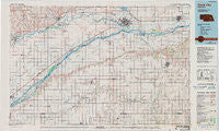
~ David City NE topo map, 1:100000 scale, 30 X 60 Minute, Historical, 1985, updated 1991
David City, Nebraska, USGS topographic map dated 1985.
Includes geographic coordinates (latitude and longitude). This topographic map is suitable for hiking, camping, and exploring, or framing it as a wall map.
Printed on-demand using high resolution imagery, on heavy weight and acid free paper, or alternatively on a variety of synthetic materials.
Topos available on paper, Waterproof, Poly, or Tyvek. Usually shipping rolled, unless combined with other folded maps in one order.
- Product Number: USGS-5563672
- Free digital map download (high-resolution, GeoPDF): David City, Nebraska (file size: 19 MB)
- Map Size: please refer to the dimensions of the GeoPDF map above
- Weight (paper map): ca. 55 grams
- Map Type: POD USGS Topographic Map
- Map Series: HTMC
- Map Verison: Historical
- Cell ID: 67385
- Scan ID: 510707
- Imprint Year: 1991
- Woodland Tint: Yes
- Photo Inspection Year: 1988
- Aerial Photo Year: 1981
- Edit Year: 1985
- Datum: NAD27
- Map Projection: Universal Transverse Mercator
- Map published by United States Geological Survey
- Map Language: English
- Scanner Resolution: 508 dpi
- Map Cell Name: David City
- Grid size: 30 X 60 Minute
- Date on map: 1985
- Map Scale: 1:100000
- Geographical region: Nebraska, United States
Neighboring Maps:
All neighboring USGS topo maps are available for sale online at a variety of scales.
Spatial coverage:
Topo map David City, Nebraska, covers the geographical area associated the following places:
- Garrison - Brainard - Riverside Park - Krakow - Sunset Acres - Polk - Lonnies Trailer Court - Silver Creek - Kronborg - Wagners Lake - Benedict - Arborville - Rising City - Genoa - Millerton - Bellwood - Richland - Havens - Stromsburg - Sheldonville - Hordville - Durant - Overland - Monroe - Fullerton - Merchiston - Ulysses - Carriage House Estates - Dwight - Surprise - Country Mobile Villa - Edholm - Genes Trailer Court - Gardiner - Osceola - Bee - College View Park - Gresham - Clarks - Schuyler - Duncan - Columbus - Heber - Octavia - Oconee - Swedehome - David City - Countryview Estates - Shelby
- Map Area ID: AREA41.541-98-97
- Northwest corner Lat/Long code: USGSNW41.5-98
- Northeast corner Lat/Long code: USGSNE41.5-97
- Southwest corner Lat/Long code: USGSSW41-98
- Southeast corner Lat/Long code: USGSSE41-97
- Northern map edge Latitude: 41.5
- Southern map edge Latitude: 41
- Western map edge Longitude: -98
- Eastern map edge Longitude: -97


