
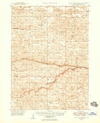
~ Dismal River Ranch NE topo map, 1:62500 scale, 15 X 15 Minute, Historical, 1949
Dismal River Ranch, Nebraska, USGS topographic map dated 1949.
Includes geographic coordinates (latitude and longitude). This topographic map is suitable for hiking, camping, and exploring, or framing it as a wall map.
Printed on-demand using high resolution imagery, on heavy weight and acid free paper, or alternatively on a variety of synthetic materials.
Topos available on paper, Waterproof, Poly, or Tyvek. Usually shipping rolled, unless combined with other folded maps in one order.
- Product Number: USGS-5563383
- Free digital map download (high-resolution, GeoPDF): Dismal River Ranch, Nebraska (file size: 10 MB)
- Map Size: please refer to the dimensions of the GeoPDF map above
- Weight (paper map): ca. 55 grams
- Map Type: POD USGS Topographic Map
- Map Series: HTMC
- Map Verison: Historical
- Cell ID: 53455
- Scan ID: 317559
- Aerial Photo Year: 1946
- Field Check Year: 1947
- Datum: NAD27
- Map Projection: Polyconic
- Map published by United States Geological Survey
- Map published by United States Bureau of Reclamation
- Map Language: English
- Scanner Resolution: 600 dpi
- Map Cell Name: Dismal River Ranch
- Grid size: 15 X 15 Minute
- Date on map: 1949
- Map Scale: 1:62500
- Geographical region: Nebraska, United States
Neighboring Maps:
All neighboring USGS topo maps are available for sale online at a variety of scales.
Spatial coverage:
Topo map Dismal River Ranch, Nebraska, covers the geographical area associated the following places:
- Haney School - Maire Ranch - Spring Creek - Sandhills Golf Course - Vandeusen School - French Ranch - Krave Ranch - Hooker County - Mullen Election Precinct - Center School - Mauser Ranch - Haney Ranch - South Fork Dismal River - Maire School - Hager Ranch - Lake School - Hatch School - Dismal River Ranch - North Fork Dismal River - Sexton Ranch - Lattin Ranch - Shimmins School
- Map Area ID: AREA4241.75-101.25-101
- Northwest corner Lat/Long code: USGSNW42-101.25
- Northeast corner Lat/Long code: USGSNE42-101
- Southwest corner Lat/Long code: USGSSW41.75-101.25
- Southeast corner Lat/Long code: USGSSE41.75-101
- Northern map edge Latitude: 42
- Southern map edge Latitude: 41.75
- Western map edge Longitude: -101.25
- Eastern map edge Longitude: -101


