
~ Tanque Verde Peak AZ topo map, 1:24000 scale, 7.5 X 7.5 Minute, Historical, 1981, updated 1993
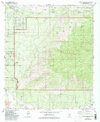
Tanque Verde Peak, Arizona, USGS topographic map dated 1981.
Includes geographic coordinates (latitude and longitude). This topographic map is suitable for hiking, camping, and exploring, or framing it as a wall map.
Printed on-demand using high resolution imagery, on heavy weight and acid free paper, or alternatively on a variety of synthetic materials.
Topos available on paper, Waterproof, Poly, or Tyvek. Usually shipping rolled, unless combined with other folded maps in one order.
- Product Number: USGS-5556450
- Free digital map download (high-resolution, GeoPDF): Tanque Verde Peak, Arizona (file size: 14 MB)
- Map Size: please refer to the dimensions of the GeoPDF map above
- Weight (paper map): ca. 55 grams
- Map Type: POD USGS Topographic Map
- Map Series: HTMC
- Map Verison: Historical
- Cell ID: 44293
- Scan ID: 313660
- Imprint Year: 1993
- Woodland Tint: Yes
- Visual Version Number: 2
- Aerial Photo Year: 1975
- Edit Year: 1993
- Field Check Year: 1976
- Datum: NAD27
- Map Projection: Transverse Mercator
- Map published by United States Geological Survey
- Map Language: English
- Scanner Resolution: 600 dpi
- Map Cell Name: Tanque Verde Peak
- Grid size: 7.5 X 7.5 Minute
- Date on map: 1981
- Map Scale: 1:24000
- Geographical region: Arizona, United States
Neighboring Maps:
All neighboring USGS topo maps are available for sale online at a variety of scales.
Spatial coverage:
Topo map Tanque Verde Peak, Arizona, covers the geographical area associated the following places:
- Fresno Spring - Box Canyon - Tanque Verde Ranch - Tanque Verde Cemetery - Old Spanish Trail Church - Tina Larga Tank - Aguila Tank - Saguaro Buttes Community Church - Rock Spring - Scotts Knob - Tanque Verde Peak - Tanque Verde Ridge Trail - Juniper Basin - Mica Tank - Wild Horse Corral - La Mesa del Oso Tank - Canyon del Salto - Rincon Creek - Sentinel Butte - Deer Camp - Tanque Verde Ranch Cemetery - Aguila Corral - La Cebadilla Lake - First Tank - Saguaro Wilderness - Steel Tank - KRKR-AM (Tucson Estates) - Gambusi Lake - Mesa de la Osa - Wild Horse Canyon - Thunderbird Ranch - Forty Niner Golf and Country Club - Hope Camp - Cement Cabin - Tanque Verde Canyon - Thunderhead Airport (historical) - Portoritas Tank - Forty-Nine Country Club
- Map Area ID: AREA32.2532.125-110.75-110.625
- Northwest corner Lat/Long code: USGSNW32.25-110.75
- Northeast corner Lat/Long code: USGSNE32.25-110.625
- Southwest corner Lat/Long code: USGSSW32.125-110.75
- Southeast corner Lat/Long code: USGSSE32.125-110.625
- Northern map edge Latitude: 32.25
- Southern map edge Latitude: 32.125
- Western map edge Longitude: -110.75
- Eastern map edge Longitude: -110.625


