
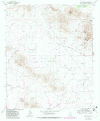
~ New River SE AZ topo map, 1:24000 scale, 7.5 X 7.5 Minute, Historical, 1964, updated 1982
New River SE, Arizona, USGS topographic map dated 1964.
Includes geographic coordinates (latitude and longitude). This topographic map is suitable for hiking, camping, and exploring, or framing it as a wall map.
Printed on-demand using high resolution imagery, on heavy weight and acid free paper, or alternatively on a variety of synthetic materials.
Topos available on paper, Waterproof, Poly, or Tyvek. Usually shipping rolled, unless combined with other folded maps in one order.
- Product Number: USGS-5554412
- Free digital map download (high-resolution, GeoPDF): New River SE, Arizona (file size: 9 MB)
- Map Size: please refer to the dimensions of the GeoPDF map above
- Weight (paper map): ca. 55 grams
- Map Type: POD USGS Topographic Map
- Map Series: HTMC
- Map Verison: Historical
- Cell ID: 31840
- Scan ID: 312621
- Imprint Year: 1982
- Woodland Tint: Yes
- Photo Revision Year: 1981
- Aerial Photo Year: 1978
- Edit Year: 1981
- Field Check Year: 1964
- Datum: NAD27
- Map Projection: Polyconic
- Map published by United States Geological Survey
- Map Language: English
- Scanner Resolution: 600 dpi
- Map Cell Name: New River SE
- Grid size: 7.5 X 7.5 Minute
- Date on map: 1964
- Map Scale: 1:24000
- Geographical region: Arizona, United States
Neighboring Maps:
All neighboring USGS topo maps are available for sale online at a variety of scales.
Spatial coverage:
Topo map New River SE, Arizona, covers the geographical area associated the following places:
- Calvary Chapel of Deseret Hills - Stepping Stones Academy - Bosco Tank - Ranieri Tank Wash - West Fork Desert Lake Wash - Rodger Creek - West Fork Apache Wash - Deer Valley Division - Paradise Wash - Gavilan Peak School - Skunk Tank Wash - Bentley Well - Crossroads Christian Fellowship - Desert Lake Wash - Daisy Mountain Fire Department Station 145 - West Fork Desert Hills Wash - Apache Peak - Diamond Canyon Elementary School - Desert Hills Fellowship Church - Desert View Bible Church - Burro Tank - Apache Spring - Gunsight - Bronco Tank - East Fork Desert Lake Wash - West Fork Paradise Wash - Desert Hills Wash - Circle Tank - East Joy Well - Jims Spring - Skunk Creek Tank - Mesquite Tank - Daisy Mountain Fire Department Station 142 - Purcell Tank - Ranieri Tank - Desert Mountain School - Anthem Census Designated Place - Desert Lake Tank - Anthem Golf and Country Club - Black Tank
- Map Area ID: AREA33.87533.75-112.125-112
- Northwest corner Lat/Long code: USGSNW33.875-112.125
- Northeast corner Lat/Long code: USGSNE33.875-112
- Southwest corner Lat/Long code: USGSSW33.75-112.125
- Southeast corner Lat/Long code: USGSSE33.75-112
- Northern map edge Latitude: 33.875
- Southern map edge Latitude: 33.75
- Western map edge Longitude: -112.125
- Eastern map edge Longitude: -112


