
~ Phoenix North AZ topo map, 1:100000 scale, 30 X 60 Minute, Historical, 1988, updated 1989
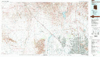
Phoenix North, Arizona, USGS topographic map dated 1988.
Includes geographic coordinates (latitude and longitude). This topographic map is suitable for hiking, camping, and exploring, or framing it as a wall map.
Printed on-demand using high resolution imagery, on heavy weight and acid free paper, or alternatively on a variety of synthetic materials.
Topos available on paper, Waterproof, Poly, or Tyvek. Usually shipping rolled, unless combined with other folded maps in one order.
- Product Number: USGS-5549192
- Free digital map download (high-resolution, GeoPDF): Phoenix North, Arizona (file size: 27 MB)
- Map Size: please refer to the dimensions of the GeoPDF map above
- Weight (paper map): ca. 55 grams
- Map Type: POD USGS Topographic Map
- Map Series: HTMC
- Map Verison: Historical
- Cell ID: 68144
- Scan ID: 315284
- Imprint Year: 1989
- Woodland Tint: Yes
- Visual Version Number: 1
- Aerial Photo Year: 1981
- Edit Year: 1988
- Datum: NAD27
- Map Projection: Universal Transverse Mercator
- Map published by United States Geological Survey
- Map Language: English
- Scanner Resolution: 600 dpi
- Map Cell Name: Phoenix North
- Grid size: 30 X 60 Minute
- Date on map: 1988
- Map Scale: 1:100000
- Geographical region: Arizona, United States
Neighboring Maps:
All neighboring USGS topo maps are available for sale online at a variety of scales.
Spatial coverage:
Topo map Phoenix North, Arizona, covers the geographical area associated the following places:
- Brandywine - Cactus Gale V - Biltmore Villas - Paradise Valley Mobile Home Park - Sun City West - Sunny Slope Mobile Home Park - Mayflower Terrace - Lake Biltmore Estates - College Park - Quail Country Place - Canyon Village - Shadow Ridge Mobile Home Park - Roles Inn of America - Lizard - Sunset Village - Glen Canyon Trailer Park - Peoria Polynesian Village - Shadow Hills Mobile Home Park - Rose Garden Place III - The Phoenix-Scottsdale Mobile Home Park - Ironwood Terrace - Paradise North Mobile Home Park - The Palms of El Mirage Mobile Home Park - Webb - Wild Flower - Moon Valley Canyon - Mountain Shadows Mobile Homes Park - Orangewood Village Mobilehome Park - The Preserve - Wellington Court - Westgreen Estates - Arrowhead Ranch - Casa del Sol Resorts Number One - Wranglers Roost - Sahara Mobile Home Park - Westbrook Village - Quail Lane - Country Ridge - Agua Fria - Desert Cypress Trailer Ranch - Dunhill Meadows - Glendale West Mobile Home Park - Palmaritas - Welcome Home Mobile Park - Lazy J Trailer Lodge - Glendale Cascade Mobile Home Park - Rose Terrace Trailer Park - Town and Country Mobile Home Park - Cheyenne Village - Val Vista Trailer Park - Union Hills Manor - Stony Mountain Villas - Villa Novena - Villa Carmel Mobile Home Park - Phoenix Mobile Home Park - Village on the Lakes - Peoria Palms Mobile Home Park - Canyon Trails Mobile Home Park - Chador Mobile Home Park - Villas Plaza - Big Reef Mill - Verde Real - Pioneer Village II - Village Park - Singing Spur Mobile Park - Santa Maria - Cottonwood Ranch - Arbor Manor Mobile Home Park - Shadow Hills - Fairwood VIII - Paradise City - Liberty Mobile Home Park - Copper Kettle Trailer Villa - San Miguel - Maryvale - Aire Libre Mobile Home Park - Westwind - Sunnyslope - Desert Skies Mobile Home Park - Aztec Mobile Home Park - Lizard Acres - Anthem - Lexington Place - Shadow Mountain - Adobe Mountain Trailer Park - Castle Hot Springs - Holiday Spa Mobile Home Park - Bonaventure Mobile Home Community - Sun City - Desert Pines - Citrus Grove Trailer Park - Shadow Canyon - Youngtown - Hoka Tiki Mobile Village - Valley View - Purple Sage Mobile Home Park - Villa Vista - Paradise Valley Oasis - Parkview North - Belaire Manor Mobile Home Park
- Map Area ID: AREA3433.5-113-112
- Northwest corner Lat/Long code: USGSNW34-113
- Northeast corner Lat/Long code: USGSNE34-112
- Southwest corner Lat/Long code: USGSSW33.5-113
- Southeast corner Lat/Long code: USGSSE33.5-112
- Northern map edge Latitude: 34
- Southern map edge Latitude: 33.5
- Western map edge Longitude: -113
- Eastern map edge Longitude: -112


