
~ Turkey Canyon AZ topo map, 1:62500 scale, 15 X 15 Minute, Historical, 1950
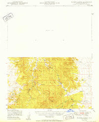
Turkey Canyon, Arizona, USGS topographic map dated 1950.
Includes geographic coordinates (latitude and longitude). This topographic map is suitable for hiking, camping, and exploring, or framing it as a wall map.
Printed on-demand using high resolution imagery, on heavy weight and acid free paper, or alternatively on a variety of synthetic materials.
Topos available on paper, Waterproof, Poly, or Tyvek. Usually shipping rolled, unless combined with other folded maps in one order.
- Product Number: USGS-5548898
- Free digital map download (high-resolution, GeoPDF): Turkey Canyon, Arizona (file size: 5 MB)
- Map Size: please refer to the dimensions of the GeoPDF map above
- Weight (paper map): ca. 55 grams
- Map Type: POD USGS Topographic Map
- Map Series: HTMC
- Map Verison: Historical
- Cell ID: 63754
- Scan ID: 315136
- Woodland Tint: Yes
- Datum: NAD27
- Map Projection: Polyconic
- Map published by United States Geological Survey
- Map published by United States Forest Service
- Map Language: English
- Scanner Resolution: 600 dpi
- Map Cell Name: Turkey Canyon
- Grid size: 15 X 15 Minute
- Date on map: 1950
- Map Scale: 1:62500
- Geographical region: Arizona, United States
Neighboring Maps:
All neighboring USGS topo maps are available for sale online at a variety of scales.
Spatial coverage:
Topo map Turkey Canyon, Arizona, covers the geographical area associated the following places:
- Sullivan Tanks - Iron King Mine - Turkey Canyon - Section Seven Well - Powerline Tank - Double O Ranch - Double O Tank - Haystack Tank - Hubbard Tank - Trick Tank - Haystack Peak - Sullivan Canyon - Trick Tank - Happy Camp Tank - Schroeder Tank - Section Ten Tank - Deer Mountain - Toad Tank - Rock Hole Tank - Hughs Tank - Mormon Peak Tank - Wolf Tank - Indian Tank - Sullivan Tank - Road Canyon Tank - Section Twentynine Well - Irving Tank - Old Military Trail - Walter Spreader Tank - Jeff Nard Tank - Purcell Canyon - Section Thirteen Tank - Lion Canyon - Dead Horse Tank - Middle Well - Section Nine Well - Jacks Tank - Atkins Well - Red Hill Tank - Juniper Mountains - Road Canyon Dam - Happy Camp Well - Red Mountain Tanks - Miller Tank - Jim Bennett Tank - Section Seventeen Tank - Section Twenty One Tank - Norton Water Tank - Spreader Dike - Section Fifteen Tank - Turkey Canyon Well - Trick Tank - Section Five Tank - Red Mountain - Trick Tank - Pine Spring Draw Tank - Charlie Weston Tank - Dunbar Mine - Cowden Ranch - New Windmill - Lower Corral Tanks - Corral Well - Turkey Flat - Deer Tank - Deep Well - Road Canyon - Hutch Tank - Yavapai Ranch - Section Thirteen Well - Big Dam Tank - Ash Fork Division - Lindberg Tank - Iron Well - Limestone Tank - Upper Tank - Lower Tank - Iron Mine Tank - Railroad Canyon - Section Eighteen Tank
- Map Area ID: AREA35.2535-113-112.75
- Northwest corner Lat/Long code: USGSNW35.25-113
- Northeast corner Lat/Long code: USGSNE35.25-112.75
- Southwest corner Lat/Long code: USGSSW35-113
- Southeast corner Lat/Long code: USGSSE35-112.75
- Northern map edge Latitude: 35.25
- Southern map edge Latitude: 35
- Western map edge Longitude: -113
- Eastern map edge Longitude: -112.75


