
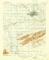
~ Phoenix AZ topo map, 1:62500 scale, 15 X 15 Minute, Historical, 1914, updated 1946
Phoenix, Arizona, USGS topographic map dated 1914.
Includes geographic coordinates (latitude and longitude). This topographic map is suitable for hiking, camping, and exploring, or framing it as a wall map.
Printed on-demand using high resolution imagery, on heavy weight and acid free paper, or alternatively on a variety of synthetic materials.
Topos available on paper, Waterproof, Poly, or Tyvek. Usually shipping rolled, unless combined with other folded maps in one order.
- Product Number: USGS-5548458
- Free digital map download (high-resolution, GeoPDF): Phoenix, Arizona (file size: 6 MB)
- Map Size: please refer to the dimensions of the GeoPDF map above
- Weight (paper map): ca. 55 grams
- Map Type: POD USGS Topographic Map
- Map Series: HTMC
- Map Verison: Historical
- Cell ID: 60956
- Scan ID: 314897
- Imprint Year: 1946
- Survey Year: 1912
- Datum: Unstated
- Map Projection: Polyconic
- Map published by United States Geological Survey
- Map Language: English
- Scanner Resolution: 600 dpi
- Map Cell Name: Phoenix
- Grid size: 15 X 15 Minute
- Date on map: 1914
- Map Scale: 1:62500
- Geographical region: Arizona, United States
Neighboring Maps:
All neighboring USGS topo maps are available for sale online at a variety of scales.
Spatial coverage:
Topo map Phoenix, Arizona, covers the geographical area associated the following places:
- Fowler - Chapparal Mobile Village - Sunrise Terrace - Maryvale Terrace - South Mountain Trailer Park - Saint Johns Mission - Rancho Mobile Estates - Blue Palm Mobile Home Park - Laveen - McDowell Trailer Village - Wigwam Villa Mobile Home Park - Roadrunner Mobile Home Park - Valley Gardens Trailer Park - Green Valley Trailer Park - La Terraza - Casa de Francisco Mobile Home Park - El Sereno-La Rosa Trailer Inn - Capri Mobile Home Park - South Phoenix - Sun Valley Trailer Park - Villa Monte Vista - Countryside Mobile Home Park - Alhambra - Legend Estates - A and F Trailer Park - Komatke - Green Acres Mobile and Recreational Vehicle Park - Palms Trailer Park - Camelback Trailer Ranch - Citrus Hills - Westwood Mobile Home Park - Co-op Village - Pecan Grove Trailer Park - La Montana Del Sur Mobile Home Park - Rancho Hermoso - Broadway Trailer Court - Estrella Estates Family Park - Bel-Aire Trailer Park - Stagecoach Trailer Park - Trail Inn Lodge - Rose Lane Trailer Park - Catalina Village - Estrella Shadows Mobile Home Park - Trailer Corral - Grandview Mobile Home Park - Patrick Park - Sun Trailer Park - Southern Acres Mobile Home Park - Maricopa Village - Michigan Trailer Park - Squaw Peak Terrace - Westridge Park - Cataline Village Mobile Home Park - Western Palms Mobile Home Community - Plaza Trailer Inn - Cartwright - Wonder Rift - Lazy D Trailer Ranch - Lazy T Mobile Home Park - Parkwood - Out West Trailer Park - Blue Bell Mobile Home Park - Mountain Gate Mobile Home Park - DeLuxe Trailer Court - La Montana del Sur - Sunburst Homes - Sunscape Homes - Sky Ridge Mobile Homes - Willows West - Phoenix - Bronze Boot - Capri Village - Hidden Acres Mobile Home Park - Lazy Daze Mobile Home Park - Gila Crossing - Aristocrat Trailer Park (historical) - Desert Gem Mobile Home Park - Southern Foothills Mobile Home Park - Sleepy Hollow Trailer Village - Country Club Trailer Grove - Western Acres Mobile Home Park - Centura West - County Fair West - Washington Trailer Park - Young America Homes - Santa Maria - Phoenix Acres Trailer Park - Thomas Trailer Court - A-1 Trailer Park - Cactus Cove Trailer Park
- Map Area ID: AREA33.533.25-112.25-112
- Northwest corner Lat/Long code: USGSNW33.5-112.25
- Northeast corner Lat/Long code: USGSNE33.5-112
- Southwest corner Lat/Long code: USGSSW33.25-112.25
- Southeast corner Lat/Long code: USGSSE33.25-112
- Northern map edge Latitude: 33.5
- Southern map edge Latitude: 33.25
- Western map edge Longitude: -112.25
- Eastern map edge Longitude: -112


