
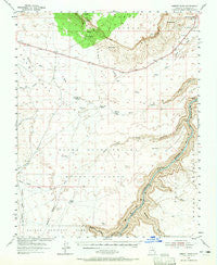
~ Emmett Wash AZ topo map, 1:62500 scale, 15 X 15 Minute, Historical, 1954, updated 1965
Emmett Wash, Arizona, USGS topographic map dated 1954.
Includes geographic coordinates (latitude and longitude). This topographic map is suitable for hiking, camping, and exploring, or framing it as a wall map.
Printed on-demand using high resolution imagery, on heavy weight and acid free paper, or alternatively on a variety of synthetic materials.
Topos available on paper, Waterproof, Poly, or Tyvek. Usually shipping rolled, unless combined with other folded maps in one order.
- Product Number: USGS-5547888
- Free digital map download (high-resolution, GeoPDF): Emmett Wash, Arizona (file size: 6 MB)
- Map Size: please refer to the dimensions of the GeoPDF map above
- Weight (paper map): ca. 55 grams
- Map Type: POD USGS Topographic Map
- Map Series: HTMC
- Map Verison: Historical
- Cell ID: 53894
- Scan ID: 314578
- Imprint Year: 1965
- Woodland Tint: Yes
- Aerial Photo Year: 1951
- Field Check Year: 1954
- Datum: NAD27
- Map Projection: Polyconic
- Map published by United States Geological Survey
- Map Language: English
- Scanner Resolution: 600 dpi
- Map Cell Name: Emmett Wash
- Grid size: 15 X 15 Minute
- Date on map: 1954
- Map Scale: 1:62500
- Geographical region: Arizona, United States
Neighboring Maps:
All neighboring USGS topo maps are available for sale online at a variety of scales.
Spatial coverage:
Topo map Emmett Wash, Arizona, covers the geographical area associated the following places:
- Roundy Creek - House Rock Valley Buffalo Range - Twentyone Mile Rapids - Hansbrough-Richards Rapid - North Canyon Point - North Canyon Rapids - Cliff Dwellers Airport - North Canyon Wash - Anderson Tank - Emmett Spring - Anderson Ranch - Twentyseven Mile Rapids - Rock Canyon - Anderson Tank - Shinumo Wash - Twentyfive Mile Rapids - To Hajisho - Emmett Hill - Sheep Spring Wash - Boulder Narrows - Cane Cairn - Tiger Wash - Sunset Spring - Soap Creek Trail - Jacobs Pool - Georgie Rapid - Marble Canyon National Monument (historical) - Pleasant Valley Outlet - Cane Canyon - Seegmiller Canyon - Cliff Dwellers Lodge - Buffalo Tanks - Twentynine Mile Rapids - Blue Clay Reservoir - Hancock Spring - Jensen Tanks - North Creek - Cram Ranch - Paria Canyon-Vermilion Cliffs Wilderness - Bean Hole Ranch - Twentynine Mile Canyon - North Canyon - Cave Springs Rapids - South Canyon - Sand Hill Crack - Twentyfour and One-half Mile Rapids - Emmett Wash
- Map Area ID: AREA36.7536.5-112-111.75
- Northwest corner Lat/Long code: USGSNW36.75-112
- Northeast corner Lat/Long code: USGSNE36.75-111.75
- Southwest corner Lat/Long code: USGSSW36.5-112
- Southeast corner Lat/Long code: USGSSE36.5-111.75
- Northern map edge Latitude: 36.75
- Southern map edge Latitude: 36.5
- Western map edge Longitude: -112
- Eastern map edge Longitude: -111.75


