
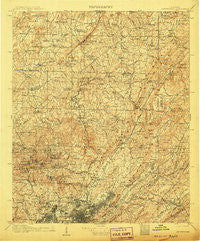
~ Birmingham AL topo map, 1:125000 scale, 30 X 30 Minute, Historical, 1907
Birmingham, Alabama, USGS topographic map dated 1907.
Includes geographic coordinates (latitude and longitude). This topographic map is suitable for hiking, camping, and exploring, or framing it as a wall map.
Printed on-demand using high resolution imagery, on heavy weight and acid free paper, or alternatively on a variety of synthetic materials.
Topos available on paper, Waterproof, Poly, or Tyvek. Usually shipping rolled, unless combined with other folded maps in one order.
- Product Number: USGS-5542687
- Free digital map download (high-resolution, GeoPDF): Birmingham, Alabama (file size: 12 MB)
- Map Size: please refer to the dimensions of the GeoPDF map above
- Weight (paper map): ca. 55 grams
- Map Type: POD USGS Topographic Map
- Map Series: HTMC
- Map Verison: Historical
- Cell ID: 65005
- Scan ID: 305811
- Survey Year: 1905
- Datum: Unstated
- Map Projection: Unstated
- Map published by United States Geological Survey
- Map Language: English
- Scanner Resolution: 600 dpi
- Map Cell Name: Birmingham
- Grid size: 30 X 30 Minute
- Date on map: 1907
- Map Scale: 1:125000
- Geographical region: Alabama, United States
Neighboring Maps:
All neighboring USGS topo maps are available for sale online at a variety of scales.
Spatial coverage:
Topo map Birmingham, Alabama, covers the geographical area associated the following places:
- Lehigh - East Haven - Cahaba Cove - Exum - Oakville - Grants Mill - Robinwood - Crumley Chapel - Remlap - Sherwood Hills - Seloca - Dallas - Valley Crest Estates - Rose Hill - Forest Park - Oakwood - Hayden - Coalburg - Godwin Estates - Birmingham - Cahaba Landing - East Thomas Gardens - Sayre - Red Wine - Elyton - Oak Park - Southern Acres - Brookmont - Bent Tree - Hobson - North Birmingham - Grayson Valley - Westwood - Altamont Park - Confederate Estates - Oak Ridge Park - Braggsville - Roebuck Springs - Harkness Crossroads - Thomas - Mountaindale - Cane Creek - Norris Junction - Springdale - Heritage Park - Pinson - Merrywood - Warrior - Eastwood - Compton - Docena - Maplewood - Whites Chapel - East Lake - Hillcrest Estates - Wylam - Mulga - Crocker Junction - New Castle - Hampton Place - Battleground - Russell Heights - Linn Crossing - Fountain Heights - Graymont - Baltimore (historical) - Sunnyside - Arrowhead - Woodcrest - Humoro - Bradford - West Ensley - Mountain Park - Zion Heights - Holiday Park Estates - Marks Village - Longview Mobile Home Park - Crosston - Cedar Grove (historical) - Roebuck Terrace - Sherman Oaks - The Colony - Paragon Estates - Nottingham - Reids - Moss Rock - Biscayne Highlands - Parsons - Lewisburg - Crestline Gardens - Black Bottom - Roebuck Crest Estates - Tuxedo Heights - Trafford - Jefferson Hills - East Irondale - Bridlewood Forest Estates - Vanderbilt - Selfville - Trussville Manor
- Map Area ID: AREA3433.5-87-86.5
- Northwest corner Lat/Long code: USGSNW34-87
- Northeast corner Lat/Long code: USGSNE34-86.5
- Southwest corner Lat/Long code: USGSSW33.5-87
- Southeast corner Lat/Long code: USGSSE33.5-86.5
- Northern map edge Latitude: 34
- Southern map edge Latitude: 33.5
- Western map edge Longitude: -87
- Eastern map edge Longitude: -86.5


