
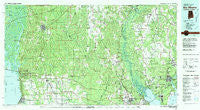
~ Bay Minette AL topo map, 1:100000 scale, 30 X 60 Minute, Historical, 1981, updated 1981
Bay Minette, Alabama, USGS topographic map dated 1981.
Includes geographic coordinates (latitude and longitude). This topographic map is suitable for hiking, camping, and exploring, or framing it as a wall map.
Printed on-demand using high resolution imagery, on heavy weight and acid free paper, or alternatively on a variety of synthetic materials.
Topos available on paper, Waterproof, Poly, or Tyvek. Usually shipping rolled, unless combined with other folded maps in one order.
- Product Number: USGS-5542579
- Free digital map download (high-resolution, GeoPDF): Bay Minette, Alabama (file size: 30 MB)
- Map Size: please refer to the dimensions of the GeoPDF map above
- Weight (paper map): ca. 55 grams
- Map Type: POD USGS Topographic Map
- Map Series: HTMC
- Map Verison: Historical
- Cell ID: 67110
- Scan ID: 305751
- Imprint Year: 1981
- Woodland Tint: Yes
- Aerial Photo Year: 1978
- Edit Year: 1981
- Datum: NAD27
- Map Projection: Universal Transverse Mercator
- Map published by United States Geological Survey
- Map Language: English
- Scanner Resolution: 600 dpi
- Map Cell Name: Bay Minette
- Grid size: 30 X 60 Minute
- Date on map: 1981
- Map Scale: 1:100000
- Geographical region: Alabama, United States
Neighboring Maps:
All neighboring USGS topo maps are available for sale online at a variety of scales.
Spatial coverage:
Topo map Bay Minette, Alabama, covers the geographical area associated the following places:
- Bay Springs - Pine Grove - Carpenter - Loxley - Windsor Place Mobile Home Park - Silverhill - Montrose - Yelling Settlement - Oyster Lodge - Mount Carmel - East Park Plaza Mobile Home Park - Pecan Park Mobile Home Park - Live Oak Mobile Home Park - Avalon Beach - Olive - Old Bratt Road Estates - Elsanor - Carney - Bluff Springs - Pine Barren - Pace - Ensley - Fidelis - Stapleton - Hurricane - Rosinton - Molino Crossroads - Yniestra - Fort McDermott - Stockton - Robertsdale - Pine Forest - Pine Haven - Houstonville - Harp - Jackson Oak - Jim's Mobile Home Park - Walnut Hill - Hughes Mobile Home Park - Gandyville - Silverhill Mobile Home Park - Allentown - Quintette - Winterhaven Court Mobile Home Park - Whitfield - Cantonment - Wallace - Buzbee Lane Mobile Home Park - Oak Grove - Seminole - Fairhope - McKinnon - Brownsdale - Tenile - Gonzalez - Blakeley - Spanish Fort - Satsuma Heights - Holly Hills - Bagdad - Blackmon Trailer Park - Dixonville - Dyas - Farm Hill - Bogia - Bratt - Rezner Mobile Home Park - Styx River Estates - Satsuma Mobile Home Park - Molino - Century - Malbis - Cottage Hill - Pineville - Muscogee - Berrydale - Magnolia Beach - Beulah - La Bonne Vie Mobile Home Park - South Flomaton - Belforest - Chumuckla Springs - Dead Lake Mobile Home Park - Meadow Breeze Mobile Home Park - Barrineau Park - Old Charles Mobile Home Park - Spence Mobile Home Park - Loyola Villa - Palm Park Mobile Home Park - Lillie's Mobile Home Park - Eastwood - Bay Minette - Vick's Mobile Home Park - Pinchona - Murray's Mobile Home Park - Brickton - Cobbtown - Seacliff - Crossroads - Mineral Springs
- Map Area ID: AREA3130.5-88-87
- Northwest corner Lat/Long code: USGSNW31-88
- Northeast corner Lat/Long code: USGSNE31-87
- Southwest corner Lat/Long code: USGSSW30.5-88
- Southeast corner Lat/Long code: USGSSE30.5-87
- Northern map edge Latitude: 31
- Southern map edge Latitude: 30.5
- Western map edge Longitude: -88
- Eastern map edge Longitude: -87


