
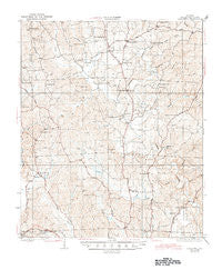
~ Samantha AL topo map, 1:62500 scale, 15 X 15 Minute, Historical, 1928, updated 1945
Samantha, Alabama, USGS topographic map dated 1928.
Includes geographic coordinates (latitude and longitude). This topographic map is suitable for hiking, camping, and exploring, or framing it as a wall map.
Printed on-demand using high resolution imagery, on heavy weight and acid free paper, or alternatively on a variety of synthetic materials.
Topos available on paper, Waterproof, Poly, or Tyvek. Usually shipping rolled, unless combined with other folded maps in one order.
- Product Number: USGS-5542469
- Free digital map download (high-resolution, GeoPDF): Samantha, Alabama (file size: 10 MB)
- Map Size: please refer to the dimensions of the GeoPDF map above
- Weight (paper map): ca. 55 grams
- Map Type: POD USGS Topographic Map
- Map Series: HTMC
- Map Verison: Historical
- Cell ID: 62054
- Scan ID: 305675
- Imprint Year: 1945
- Visual Version Number: 3
- Survey Year: 1926
- Datum: NAD
- Map Projection: Polyconic
- Map published by United States Geological Survey
- Map Language: English
- Scanner Resolution: 600 dpi
- Map Cell Name: Samantha
- Grid size: 15 X 15 Minute
- Date on map: 1928
- Map Scale: 1:62500
- Geographical region: Alabama, United States
Neighboring Maps:
All neighboring USGS topo maps are available for sale online at a variety of scales.
Spatial coverage:
Topo map Samantha, Alabama, covers the geographical area associated the following places:
- Chestnut Hill - Bridgeview - Telmar Subdivision - Smoke Rise - Samantha - Chewalla - Driftwood Estates - Northcliff - North River Country Club Estates - Montgomery Lakes - Bel Air Estates - Skelton Bend Estates - Batchelor Subdivision - Georgena Terrace - Stonehedge Cliffs - Lakeland Forest - North Valley Acres - Binion Heights - Flatwoods - Yacht Club Bay - Sartains Ridgecrest Subdivision - Cloverdale Estates - Clearwater Estates - Edwardian Place - North Haven - Candlewood - Cherokee Shores - Western Hills Estates - Holiday Shores - Four Winds - Lake Hills North - Arnedra Subdivision - Western Hills - High Cliff - Mariners Cove - Appling Bend - Lakewood - Cove Park - Burnt Pine - Searcy Farms - Briarcliff - Beacon Point - Saratoga Estates - Hagler Mill Estates - Camile Terrace - Westhill - Huntington Place - Pinedale - Vista Granda - Lake Front Village - North Riviera - Highview - Mount Olive - Northwood Forest - Stonehedge - Hamner Estates - North River Shores - Wood Estates - Demarest - Carolwood Estates - Northcrest - Lakeview Manor - Graceland Acres - Lake Cove - Lavender Acres - Wood Village - Lakeview Estates - Willow Point - Northwood Lake - Chapelwood - Carolwood - Shirley - Monterey Drive - Thorndale - Loganwood
- Map Area ID: AREA33.533.25-87.75-87.5
- Northwest corner Lat/Long code: USGSNW33.5-87.75
- Northeast corner Lat/Long code: USGSNE33.5-87.5
- Southwest corner Lat/Long code: USGSSW33.25-87.75
- Southeast corner Lat/Long code: USGSSE33.25-87.5
- Northern map edge Latitude: 33.5
- Southern map edge Latitude: 33.25
- Western map edge Longitude: -87.75
- Eastern map edge Longitude: -87.5


