
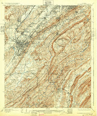
~ Bessemer Iron District AL topo map, 1:62500 scale, 15 X 15 Minute, Historical, 1907, updated 1932
Bessemer Iron District, Alabama, USGS topographic map dated 1907.
Includes geographic coordinates (latitude and longitude). This topographic map is suitable for hiking, camping, and exploring, or framing it as a wall map.
Printed on-demand using high resolution imagery, on heavy weight and acid free paper, or alternatively on a variety of synthetic materials.
Topos available on paper, Waterproof, Poly, or Tyvek. Usually shipping rolled, unless combined with other folded maps in one order.
- Product Number: USGS-5542189
- Free digital map download (high-resolution, GeoPDF): Bessemer Iron District, Alabama (file size: 12 MB)
- Map Size: please refer to the dimensions of the GeoPDF map above
- Weight (paper map): ca. 55 grams
- Map Type: POD USGS Topographic Map
- Map Series: HTMC
- Map Verison: Historical
- Cell ID: 51255
- Scan ID: 305497
- Imprint Year: 1932
- Survey Year: 1905
- Datum: NAD
- Map Projection: Polyconic
- Map published by United States Geological Survey
- Map Language: English
- Scanner Resolution: 600 dpi
- Map Cell Name: Bessemer Iron District
- Grid size: 15 X 15 Minute
- Date on map: 1907
- Map Scale: 1:62500
- Geographical region: Alabama, United States
Neighboring Maps:
All neighboring USGS topo maps are available for sale online at a variety of scales.
Spatial coverage:
Topo map Bessemer Iron District, Alabama, covers the geographical area associated the following places:
- Green View Estates - Dunaway Farms - Pine Crest - Ensley Junction - Keystone - Heatherwood - West End - Richmond Place - Mossboro - Fairfield Village - Belle Haven - Rosedale - Muscoda - Wooddale - Twin Bridge - Winetka - Kingwood - Hopewell - Vestridge - Hudson Grove - Martins - Wheeling Crossroad - Hollywood - Fairfield Highlands - Indian Hills - West Highlands - Interurban Heights - Jones Valley - Tanglewood - Blue Creek Junction - Lochridge - Beverly Station - Patton Chapel - Acton - Shades Acres - Bessemer Junction - Bessemer - Scottrock - Crescent Heights - Rice - Fairfield - Grasselli - Dolomite - Countrywood Highlands - Chestnut Glen - Mallard Point - Highlands - Oak Hills - Brickyard Junction - Weeping Oaks - Brownville - Surrey Hill - Highland Crest - Jonesboro - Vesclub Estates - Cottage Hill - Shannon Glen - Shadywood - Timbercrest - Mountain Woods Park - Paramount - Monte D'Oro - Powderly - Dearing Downs - Valley Forge - Mountain Brook Village - Kenwood - West Lake Highlands - Tacoa - Ivy Glenn - Glen Iris - Oxmoor - Powderly Hills - Glen Hills - Wisteria Commons - Woodward Estates - Lakeview Estates - Lakeview Park - Shades Run - Pleasant Grove - Park Place - Country Ridge Estates - Belwood - Longbrook Estates - Coalmont - Woodmeadows - Tarpley - Loch Haven - North Highlands - Parkwood Hills - East Brighton - Shades View Estates - Bessemer Homestead - Hidden Ridge - Indian Springs Ranch - Valhalla - Windsor Highlands - Rocky Ridge Manor - Millbrook Estates - Stonebrook Park
- Map Area ID: AREA33.533.25-87-86.75
- Northwest corner Lat/Long code: USGSNW33.5-87
- Northeast corner Lat/Long code: USGSNE33.5-86.75
- Southwest corner Lat/Long code: USGSSW33.25-87
- Southeast corner Lat/Long code: USGSSE33.25-86.75
- Northern map edge Latitude: 33.5
- Southern map edge Latitude: 33.25
- Western map edge Longitude: -87
- Eastern map edge Longitude: -86.75


