
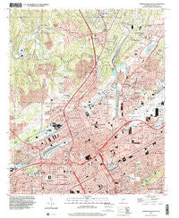
~ Birmingham North AL topo map, 1:24000 scale, 7.5 X 7.5 Minute, Historical, 1997, updated 2001
Birmingham North, Alabama, USGS topographic map dated 1997.
Includes geographic coordinates (latitude and longitude). This topographic map is suitable for hiking, camping, and exploring, or framing it as a wall map.
Printed on-demand using high resolution imagery, on heavy weight and acid free paper, or alternatively on a variety of synthetic materials.
Topos available on paper, Waterproof, Poly, or Tyvek. Usually shipping rolled, unless combined with other folded maps in one order.
- Product Number: USGS-5537821
- Free digital map download (high-resolution, GeoPDF): Birmingham North, Alabama (file size: 17 MB)
- Map Size: please refer to the dimensions of the GeoPDF map above
- Weight (paper map): ca. 55 grams
- Map Type: POD USGS Topographic Map
- Map Series: HTMC
- Map Verison: Historical
- Cell ID: 4001
- Scan ID: 303242
- Imprint Year: 2001
- Woodland Tint: Yes
- Aerial Photo Year: 1997
- Datum: NAD83
- Map Projection: Universal Transverse Mercator
- Map published by United States Geological Survey
- Map Language: English
- Scanner Resolution: 600 dpi
- Map Cell Name: Birmingham North
- Grid size: 7.5 X 7.5 Minute
- Date on map: 1997
- Map Scale: 1:24000
- Geographical region: Alabama, United States
Neighboring Maps:
All neighboring USGS topo maps are available for sale online at a variety of scales.
Spatial coverage:
Topo map Birmingham North, Alabama, covers the geographical area associated the following places:
- Fultondale Estates - Boyles Highlands - Owenton - Highland Residence Park - Avondale - Franklin Gardens - Tarrant - Meadwood Heights - Elyton - East Birmingham - Pratt City - Black Creek - Oak Lawn - East Thomas - Hayes Highland - Upper Coalburg - Fulton Springs - Bendale - Birmingham - North Birmingham - Oak Forest - Oakhurst - Redmont Park - Graysons Addition - Inglenook - Ingle Terrace - Smithfield - Acipcoville - Forest Park - Norwood - East Thomas Gardens - Woodlawn - Village Creek - Parker Heights - Thomas - Eastwood - Harriman Park - Five Points South - Zion Heights - Spring Garden - Plain View - Humoro - Graymont - Park Place - Jefferson Hills - East Boyles - Springdale - Fountain Heights - Avon Park - Lewisburg - Washington Heights - Magnolia Heights - Tarrant Garden Estates - Ketona - Bartonville - Douglasville - Oak Park - Frances Heights - Hooper City - Coalburg - Glendale - Crestline Heights - Danville - Mountain Brook - Vulcan City - Sayreton - Vanderbilt - Fultondale - Walker Chapel - Kingston - Altamont Park - Fairfield - Tarrant Heights - Mountain Park - Greenleas Heights
- Map Area ID: AREA33.62533.5-86.875-86.75
- Northwest corner Lat/Long code: USGSNW33.625-86.875
- Northeast corner Lat/Long code: USGSNE33.625-86.75
- Southwest corner Lat/Long code: USGSSW33.5-86.875
- Southeast corner Lat/Long code: USGSSE33.5-86.75
- Northern map edge Latitude: 33.625
- Southern map edge Latitude: 33.5
- Western map edge Longitude: -86.875
- Eastern map edge Longitude: -86.75


