
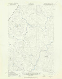
~ Seven Islands ME topo map, 1:62500 scale, 15 X 15 Minute, Historical, 1955, updated 1956
Seven Islands, Maine, USGS topographic map dated 1955.
Includes geographic coordinates (latitude and longitude). This topographic map is suitable for hiking, camping, and exploring, or framing it as a wall map.
Printed on-demand using high resolution imagery, on heavy weight and acid free paper, or alternatively on a variety of synthetic materials.
Topos available on paper, Waterproof, Poly, or Tyvek. Usually shipping rolled, unless combined with other folded maps in one order.
- Product Number: USGS-5537055
- Free digital map download (high-resolution, GeoPDF): Seven Islands, Maine (file size: 5 MB)
- Map Size: please refer to the dimensions of the GeoPDF map above
- Weight (paper map): ca. 55 grams
- Map Type: POD USGS Topographic Map
- Map Series: HTMC
- Map Verison: Historical
- Cell ID: 62345
- Scan ID: 306774
- Imprint Year: 1956
- Aerial Photo Year: 1952
- Field Check Year: 1955
- Datum: NAD27
- Map Projection: Polyconic
- Provisional map: Yes
- Map published by United States Geological Survey
- Map published by United States Army Corps of Engineers
- Map Language: English
- Scanner Resolution: 600 dpi
- Map Cell Name: Seven Islands
- Grid size: 15 X 15 Minute
- Date on map: 1955
- Map Scale: 1:62500
- Geographical region: Maine, United States
Neighboring Maps:
All neighboring USGS topo maps are available for sale online at a variety of scales.
Spatial coverage:
Topo map Seven Islands, Maine, covers the geographical area associated the following places:
- Priestly Brook - T14 R14 WELS - Bruleau Pond - Fivemile Brook - Branch of Fivemile Brook - Charles Pond - Seven Islands - Houlton Pond - Lizotte Brook - White Pond - Ninemile Deadwater - T15 R14 WELS - Saint Amants Brook - Conners Brook - T15 R15 WELS - Shields Branch - White Brook - Western Ledge - T13 R15 WELS - Little Saint Roch River - Blood Lake - Depot Stream - T14 R15 WELS - Priestly Rapids - Fourmile Brook - T13 R14 WELS
- Map Area ID: AREA4746.75-69.75-69.5
- Northwest corner Lat/Long code: USGSNW47-69.75
- Northeast corner Lat/Long code: USGSNE47-69.5
- Southwest corner Lat/Long code: USGSSW46.75-69.75
- Southeast corner Lat/Long code: USGSSE46.75-69.5
- Northern map edge Latitude: 47
- Southern map edge Latitude: 46.75
- Western map edge Longitude: -69.75
- Eastern map edge Longitude: -69.5


