
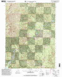
~ Whisky Bill Peak CA topo map, 1:24000 scale, 7.5 X 7.5 Minute, Historical, 1998, updated 2003
Whisky Bill Peak, California, USGS topographic map dated 1998.
Includes geographic coordinates (latitude and longitude). This topographic map is suitable for hiking, camping, and exploring, or framing it as a wall map.
Printed on-demand using high resolution imagery, on heavy weight and acid free paper, or alternatively on a variety of synthetic materials.
Topos available on paper, Waterproof, Poly, or Tyvek. Usually shipping rolled, unless combined with other folded maps in one order.
- Product Number: USGS-5526063
- Free digital map download (high-resolution, GeoPDF): Whisky Bill Peak, California (file size: 22 MB)
- Map Size: please refer to the dimensions of the GeoPDF map above
- Weight (paper map): ca. 55 grams
- Map Type: POD USGS Topographic Map
- Map Series: HTMC
- Map Verison: Historical
- Cell ID: 48604
- Scan ID: 102152
- Imprint Year: 2003
- Woodland Tint: Yes
- Aerial Photo Year: 1997
- Edit Year: 1998
- Datum: NAD27
- Map Projection: Lambert Conformal Conic
- Map published by United States Forest Service
- Map Language: English
- Scanner Resolution: 600 dpi
- Map Cell Name: Whisky Bill Peak
- Grid size: 7.5 X 7.5 Minute
- Date on map: 1998
- Map Scale: 1:24000
- Geographical region: California, United States
Neighboring Maps:
All neighboring USGS topo maps are available for sale online at a variety of scales.
Spatial coverage:
Topo map Whisky Bill Peak, California, covers the geographical area associated the following places:
- Halls Gulch - Red Mountain - Pond Lily Creek - Highland Lakes - Gozem Peak - Mumbo Creek - Highland Mine - Cedar Creek - Devils Lake - East Fork Trinity River - Grouse Creek - Devils Creek - State Mountain - Wildcat Peak - Shoemaker Gulch - Blue Ridge - Whipple Ranch - Grouse Lake - China Creek - Cabin Gulch - Pond Lily Lake - Watson Creek - Bear Flat - Whisky Bill Peak - Fool Gulch
- Map Area ID: AREA41.12541-122.625-122.5
- Northwest corner Lat/Long code: USGSNW41.125-122.625
- Northeast corner Lat/Long code: USGSNE41.125-122.5
- Southwest corner Lat/Long code: USGSSW41-122.625
- Southeast corner Lat/Long code: USGSSE41-122.5
- Northern map edge Latitude: 41.125
- Southern map edge Latitude: 41
- Western map edge Longitude: -122.625
- Eastern map edge Longitude: -122.5


