
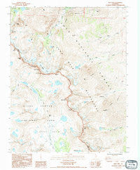
~ Split Mtn CA topo map, 1:24000 scale, 7.5 X 7.5 Minute, Historical, 1990, updated 1995
Split Mtn, California, USGS topographic map dated 1990.
Includes geographic coordinates (latitude and longitude). This topographic map is suitable for hiking, camping, and exploring, or framing it as a wall map.
Printed on-demand using high resolution imagery, on heavy weight and acid free paper, or alternatively on a variety of synthetic materials.
Topos available on paper, Waterproof, Poly, or Tyvek. Usually shipping rolled, unless combined with other folded maps in one order.
- Product Number: USGS-5523811
- Free digital map download (high-resolution, GeoPDF): Split Mtn, California (file size: 14 MB)
- Map Size: please refer to the dimensions of the GeoPDF map above
- Weight (paper map): ca. 55 grams
- Map Type: POD USGS Topographic Map
- Map Series: HTMC
- Map Verison: Historical
- Cell ID: 71684
- Scan ID: 295281
- Imprint Year: 1995
- Woodland Tint: Yes
- Photo Inspection Year: 1990
- Aerial Photo Year: 1990
- Datum: NAD27
- Map Projection: Universal Transverse Mercator
- Provisional map: Yes
- Map published by United States Geological Survey
- Map Language: English
- Scanner Resolution: 600 dpi
- Map Cell Name: Split Mountain
- Grid size: 7.5 X 7.5 Minute
- Date on map: 1990
- Map Scale: 1:24000
- Geographical region: California, United States
Neighboring Maps:
All neighboring USGS topo maps are available for sale online at a variety of scales.
Spatial coverage:
Topo map Split Mtn, California, covers the geographical area associated the following places:
- Finger Lake - Split Mountain - Disappointment Peak - Big Pine Creek Campground - Birch Mountain - Southfork Pass - Big Pine Creek South Fork Trailhead - The Thumb - Brainerd Lake - Blue Star Mines - Upper Basin - Mount Bolton Brown - Contact Pass - Mount Prater - North Fork Big Pine Creek - Palisade Crest - Norman Clyde Glacier - Temple Crag - Middle Palisade - Mather Pass - Elinor Lake - Tinemaha Lake - Kid Mountain - Second Lake - South Fork Big Pine Creek - Mount Tinemaha - Middle Palisade Glacier - Big Pine Creek Number 2 6-011 Dam - Palisade Lakes - Mount Jepson - Third Lake - Norman Clyde Peak - Red Lake - Willow Lake - Mount Alice - Birch Campground - Birch Lake
- Map Area ID: AREA37.12537-118.5-118.375
- Northwest corner Lat/Long code: USGSNW37.125-118.5
- Northeast corner Lat/Long code: USGSNE37.125-118.375
- Southwest corner Lat/Long code: USGSSW37-118.5
- Southeast corner Lat/Long code: USGSSE37-118.375
- Northern map edge Latitude: 37.125
- Southern map edge Latitude: 37
- Western map edge Longitude: -118.5
- Eastern map edge Longitude: -118.375


