
~ South Yolla Bolly Mountains CA topo map, 1:24000 scale, 7.5 X 7.5 Minute, Historical, 1995, updated 2001
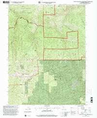
South Yolla Bolly Mountains, California, USGS topographic map dated 1995.
Includes geographic coordinates (latitude and longitude). This topographic map is suitable for hiking, camping, and exploring, or framing it as a wall map.
Printed on-demand using high resolution imagery, on heavy weight and acid free paper, or alternatively on a variety of synthetic materials.
Topos available on paper, Waterproof, Poly, or Tyvek. Usually shipping rolled, unless combined with other folded maps in one order.
- Product Number: USGS-5523781
- Free digital map download (high-resolution, GeoPDF): South Yolla Bolly Mountains, California (file size: 18 MB)
- Map Size: please refer to the dimensions of the GeoPDF map above
- Weight (paper map): ca. 55 grams
- Map Type: POD USGS Topographic Map
- Map Series: HTMC
- Map Verison: Historical
- Cell ID: 42312
- Scan ID: 295273
- Imprint Year: 2001
- Woodland Tint: Yes
- Aerial Photo Year: 1993
- Edit Year: 1995
- Datum: NAD27
- Map Projection: Lambert Conformal Conic
- Map published by United States Geological Survey
- Map published by United States Forest Service
- Map Language: English
- Scanner Resolution: 600 dpi
- Map Cell Name: South Yolla Bolly Mountains
- Grid size: 7.5 X 7.5 Minute
- Date on map: 1995
- Map Scale: 1:24000
- Geographical region: California, United States
Neighboring Maps:
All neighboring USGS topo maps are available for sale online at a variety of scales.
Spatial coverage:
Topo map South Yolla Bolly Mountains, California, covers the geographical area associated the following places:
- Prine Cabin - Horsepacker Trailhead - Browns Camp - Slides Ridge - Hamilton Glade - South Yolla Bolly Mountains - Browns Camp Trailhead - Trough Spring Ridge - Long Lake - Ideas Cove Traihead - Elkhorn Peak - Prine Cabin - Elkhorn Creek - Slides Creek - Twin Peaks - Thunder Camp - Harvey Creek - South Yolla Bolly - Fish Ridge - Toomes Camp - Mount Linn - Plum Garden - Valentine Spring - Toomes Camp - Slides Glade - Cedar Basin Camp - Syd Cabin Glade - Harding Spring - Buck Creek - Oven Lid - Valentine Ridge - Square Lake - Burnt Camp - Sulphur Creek - Pole Corral - Hamilton Gulch - Ides Cove
- Map Area ID: AREA40.12540-122.875-122.75
- Northwest corner Lat/Long code: USGSNW40.125-122.875
- Northeast corner Lat/Long code: USGSNE40.125-122.75
- Southwest corner Lat/Long code: USGSSW40-122.875
- Southeast corner Lat/Long code: USGSSE40-122.75
- Northern map edge Latitude: 40.125
- Southern map edge Latitude: 40
- Western map edge Longitude: -122.875
- Eastern map edge Longitude: -122.75


