
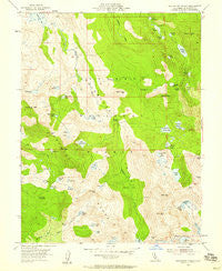
~ Rockbound Valley CA topo map, 1:24000 scale, 7.5 X 7.5 Minute, Historical, 1955, updated 1959
Rockbound Valley, California, USGS topographic map dated 1955.
Includes geographic coordinates (latitude and longitude). This topographic map is suitable for hiking, camping, and exploring, or framing it as a wall map.
Printed on-demand using high resolution imagery, on heavy weight and acid free paper, or alternatively on a variety of synthetic materials.
Topos available on paper, Waterproof, Poly, or Tyvek. Usually shipping rolled, unless combined with other folded maps in one order.
- Product Number: USGS-5521873
- Free digital map download (high-resolution, GeoPDF): Rockbound Valley, California (file size: 13 MB)
- Map Size: please refer to the dimensions of the GeoPDF map above
- Weight (paper map): ca. 55 grams
- Map Type: POD USGS Topographic Map
- Map Series: HTMC
- Map Verison: Historical
- Cell ID: 38283
- Scan ID: 294764
- Imprint Year: 1959
- Woodland Tint: Yes
- Aerial Photo Year: 1953
- Field Check Year: 1955
- Datum: NAD27
- Map Projection: Polyconic
- Map published by United States Geological Survey
- Map Language: English
- Scanner Resolution: 600 dpi
- Map Cell Name: Rockbound Valley
- Grid size: 7.5 X 7.5 Minute
- Date on map: 1955
- Map Scale: 1:24000
- Geographical region: California, United States
Neighboring Maps:
All neighboring USGS topo maps are available for sale online at a variety of scales.
Spatial coverage:
Topo map Rockbound Valley, California, covers the geographical area associated the following places:
- Lake Number Five - Lake Number Nine - Fontanillis Lake - Clyde Lake - McConnell Lake - Middle Velma Lake - Tyler Lake - Onion Flat - Rockbound Valley - Lake Genevieve - Lake Doris - Rubicon Lake - Schmidell Lake 1-029 Dam - Top Lake - Rubicon 1009-009 Dam - Dicks Lake - Desolation Wilderness - Camper Flat - Crystal Range - China Flat - Stony Ridge Lake - Middle Mountain - Lake Zitella - Lake Lois - Upper Velma Lake - Lost Lake - Horseshoe Lake - Lawrence Lake - Lake Number Three - Highland Lake 1-031 Dam - Phipps Creek - Dicks Pass - Cliff Lake - Stony Ridge Lake 1-032 Dam - Dicks Peak - Phipps Peak - Crag Lake - Rockbound Pass - Grouse Lakes - Kalmia Lake - Phipps Pass - Lake Schmidell - Alta Morris Lake - Barrett Lake - Willow Flat - Island Lake - Highland Lake - Leland Lakes - Silver Peak - Jacks Peak - Mosquito Pass - Shadow Lake - McConnell Peak - Half Moon Lake - Rubicon Reservoir - Rockbound Lake - Susie Lake - Phipps Lake - Lower Velma Lake - Red Peak - Fox Lake - Heather Lake - Maude Lake - University of California Cow Camp - Hidden Lake - Gertrude Lake - Four-Q Lakes - Rubicon Peak
- Map Area ID: AREA3938.875-120.25-120.125
- Northwest corner Lat/Long code: USGSNW39-120.25
- Northeast corner Lat/Long code: USGSNE39-120.125
- Southwest corner Lat/Long code: USGSSW38.875-120.25
- Southeast corner Lat/Long code: USGSSE38.875-120.125
- Northern map edge Latitude: 39
- Southern map edge Latitude: 38.875
- Western map edge Longitude: -120.25
- Eastern map edge Longitude: -120.125


