
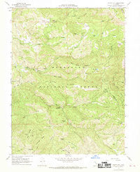
~ Potato Hill CA topo map, 1:24000 scale, 7.5 X 7.5 Minute, Historical, 1967, updated 1969
Potato Hill, California, USGS topographic map dated 1967.
Includes geographic coordinates (latitude and longitude). This topographic map is suitable for hiking, camping, and exploring, or framing it as a wall map.
Printed on-demand using high resolution imagery, on heavy weight and acid free paper, or alternatively on a variety of synthetic materials.
Topos available on paper, Waterproof, Poly, or Tyvek. Usually shipping rolled, unless combined with other folded maps in one order.
- Product Number: USGS-5521127
- Free digital map download (high-resolution, GeoPDF): Potato Hill, California (file size: 15 MB)
- Map Size: please refer to the dimensions of the GeoPDF map above
- Weight (paper map): ca. 55 grams
- Map Type: POD USGS Topographic Map
- Map Series: HTMC
- Map Verison: Historical
- Cell ID: 36165
- Scan ID: 294348
- Imprint Year: 1969
- Woodland Tint: Yes
- Aerial Photo Year: 1965
- Field Check Year: 1967
- Datum: NAD27
- Map Projection: Polyconic
- Map published by United States Geological Survey
- Map Language: English
- Scanner Resolution: 600 dpi
- Map Cell Name: Potato Hill
- Grid size: 7.5 X 7.5 Minute
- Date on map: 1967
- Map Scale: 1:24000
- Geographical region: California, United States
Neighboring Maps:
All neighboring USGS topo maps are available for sale online at a variety of scales.
Spatial coverage:
Topo map Potato Hill, California, covers the geographical area associated the following places:
- Big Spring - French Creek - North Glade - Salt Creek - Catfish Pond - Snow Mountain House - Blue Slides Ridge - Sumner Ridge - Bear Creek Station - Barker Creek - Bear Creek Campground - Richardson Glade - Long Ridge - Big Ridge - Rock Creek - Bear Creek - Parramore Creek - Little Horse Mountain - Knobcone Spring - Hale Ridge - Summit Springs Trailhead Parking - Youngs Corral (historical) - Upper Lake-Clearlake Oaks Division - Summit Spring - Rice Valley - Youngs Corral Spring - Rabbit Glade Spring - Summit Springs Trailhead - Dry Creek - Madrone Spring - Blue Slides Lake - Mauser Glade - Fir Root Spring - McLeod Creek - Blue Slides Creek - Timber Lake - Little Soda Creek - Crabtree Hot Springs - Potato Hill
- Map Area ID: AREA39.37539.25-122.875-122.75
- Northwest corner Lat/Long code: USGSNW39.375-122.875
- Northeast corner Lat/Long code: USGSNE39.375-122.75
- Southwest corner Lat/Long code: USGSSW39.25-122.875
- Southeast corner Lat/Long code: USGSSE39.25-122.75
- Northern map edge Latitude: 39.375
- Southern map edge Latitude: 39.25
- Western map edge Longitude: -122.875
- Eastern map edge Longitude: -122.75


