
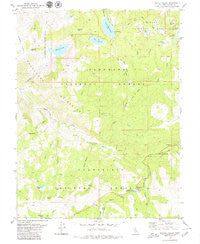
~ Pacific Valley CA topo map, 1:24000 scale, 7.5 X 7.5 Minute, Historical, 1979, updated 1979
Pacific Valley, California, USGS topographic map dated 1979.
Includes geographic coordinates (latitude and longitude). This topographic map is suitable for hiking, camping, and exploring, or framing it as a wall map.
Printed on-demand using high resolution imagery, on heavy weight and acid free paper, or alternatively on a variety of synthetic materials.
Topos available on paper, Waterproof, Poly, or Tyvek. Usually shipping rolled, unless combined with other folded maps in one order.
- Product Number: USGS-5520183
- Free digital map download (high-resolution, GeoPDF): Pacific Valley, California (file size: 11 MB)
- Map Size: please refer to the dimensions of the GeoPDF map above
- Weight (paper map): ca. 55 grams
- Map Type: POD USGS Topographic Map
- Map Series: HTMC
- Map Verison: Historical
- Cell ID: 33840
- Scan ID: 293841
- Imprint Year: 1979
- Woodland Tint: Yes
- Visual Version Number: 2
- Aerial Photo Year: 1973
- Edit Year: 1979
- Field Check Year: 1974
- Datum: NAD27
- Map Projection: Lambert Conformal Conic
- Map published by United States Geological Survey
- Map Language: English
- Scanner Resolution: 600 dpi
- Map Cell Name: Pacific Valley
- Grid size: 7.5 X 7.5 Minute
- Date on map: 1979
- Map Scale: 1:24000
- Geographical region: California, United States
Neighboring Maps:
All neighboring USGS topo maps are available for sale online at a variety of scales.
Spatial coverage:
Topo map Pacific Valley, California, covers the geographical area associated the following places:
- Middle Creek - Granite Lake - Mosquito Lakes Picnic Area - Stevenot Camp - Hermit Valley - Hellhole Lake - Meadow Lake 97-063 Dam - Jackson Canyon - Blue Creek - Tamarack Lake - Mosquito Lakes Campground - Lily Pad Lake - Monte Wolf Upper Cabin - Avalanche Meadow - Tamarac Lake 513-005 Dam - Deer Valley - Sandy Meadow - Lower Blue Lake Campground - Hermit Valley Campground - Stanislaus Meadow - Pacific Grade Summit - Cliff Meadow - Clover Valley - Pacific Creek - Grouse Creek - Lower Sunset Lake - Twin Lake - Meadow Lake - Lower Sunset 513-003 Dam - Mosquito Lake - Blue Lakes Trailhead - Lower Blue Lake 97-062 Dam - Wheeler Lake - Pacific Valley - Evergreen Lake - Lower Blue Lake - Rice Lake - Mokelumne Wilderness - Twin Lakes 97-069 Dam - Cache Creek - Summit Lake Dam - Sandy Meadow Creek - Woodchuck Basin - Deadwood Lake - Little Indian Valley - Pacific Valley Campground - Upper Sunset Lake 513-007 Dam - Snow Canyon - Deer Creek - Upper Sunset Lake
- Map Area ID: AREA38.62538.5-120-119.875
- Northwest corner Lat/Long code: USGSNW38.625-120
- Northeast corner Lat/Long code: USGSNE38.625-119.875
- Southwest corner Lat/Long code: USGSSW38.5-120
- Southeast corner Lat/Long code: USGSSE38.5-119.875
- Northern map edge Latitude: 38.625
- Southern map edge Latitude: 38.5
- Western map edge Longitude: -120
- Eastern map edge Longitude: -119.875


